Moviliţa geodata
Moviliţa (Vrancea) is a seat of a second-order administrative division; located in Romania in Europe/Bucharest (GMT+3) time zone. With population of 3,911 people, there are 1205 cities with bigger population in this country. Compared to other cities in Romania, 54% of cities are located further ↓South; 85.1% of cities are located further ←West and 54.4% of cities have higher elevation than Moviliţa. Note1


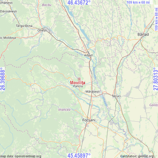
Moviliţa GPS coordinates[2]
45° 57' 0" North, 27° 6' 0" East
| Map corner | latitude | longitude |
|---|---|---|
| Upper-left | 46.43672°, | 26.39688° |
| Center: | 45.95°, | 27.1° |
| Lower-right: | 45.45897°, | 27.80313° |
| Map W x H: | 108.7×108.7 km | = 67.5×67.5mi |
| max Lat: | 48.23793° ⇑46% North |
| Moviliţa: | 45.95° |
| min Lat: | ⇓54% South 43.65638° |
| min Long | Moviliţa | max Long |
| 20.31667° | 27.1° | 29.65403° |
| W 85.1%⇐ | ⇒14.9% E |
Elevation
Elevation of Moviliţa is 190 m = 623 ft, and this is 64.9 m = 213 ft below average elevation for this country.
| Max E: |
1278 m = 4193 ft | 54.4% |
| Avg. | 254.9 m = 836 ft | |
| Moviliţa | 190 m = 623 ft | |
Min E: |
-2 m = -7 ft | 45.6% |
See also: Romania elevation on elevation.city.
Geographical zone
Moviliţa is located in North temperate zone (between Tropic of Cancer and the Arctic Circle). Distance of this North polar circle is 2292 km =1424.2 mi to North.| Distance of | km | miles | from Moviliţa |
|---|---|---|---|
| North Pole | 4897.9 | 3043.4 | to North |
| Arctic Circle | 2292 | 1424.2 | to North |
| Tropic Cancer | 2503.2 | 1555.4 | to South |
| Equator | 5109.2 | 3174.7 | to South |


Nearby cities:
15 places around Moviliţa: (largest is in red/bold)
• Crucea de Sus
3.8 km =2.4 mi,  199°
199°
• Călimănești
9.2 km =5.7 mi,  81°
81°
• Diocheți-Rediu
3.7 km =2.3 mi,  125°
125°
• Dumbrava
4.6 km =2.9 mi,  167°
167°
• Fitioneşti
5.4 km =3.4 mi,  313°
313°
• Haret
9.2 km =5.7 mi,  111°
111°
• Muncelu
5.3 km =3.3 mi,  272°
272°
• Neicu
4.2 km =2.6 mi,  207°
207°
• Panciu
5.7 km =3.5 mi,  193°
193°
• Pufeşti
9.5 km =5.9 mi,  54°
54°
• Păuneşti
9.3 km =5.8 mi,  0°
0°
• Satu Nou
6.7 km =4.2 mi,  181°
181°
• Străoane
4.3 km =2.7 mi,  244°
244°
• Sârbi
9.3 km =5.8 mi, 196°
• Vitănești
8.7 km =5.4 mi, 212°
Sources, notices
• [Note1] Compared only with cities in Romania existing in our database
• [Src1] Map data: © OpenStreetMap contributors (CC-BY-SA)
• [Src2] Other city data from geonames.org with taken over terms of usage.
• [Src3] Geographical zone / Annual Mean Temperature by Robert A. Rohde @ Wikipedia
