Straja geodata
Straja (Bacău) is a populated place; located in Romania in Europe/Bucharest (GMT+3) time zone. With population of 1,316 people, there are 3486 cities with bigger population in this country. Compared to other cities in Romania, 65.6% of cities are located further ↓South; 70.2% of cities are located further ←West and 86.6% of cities have lower elevation than Straja. Note1


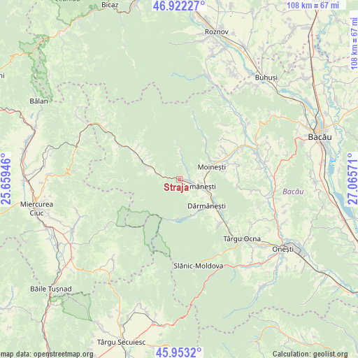
Straja GPS coordinates[2]
46° 26' 23.604" North, 26° 21' 45.288" East
| Map corner | latitude | longitude |
|---|---|---|
| Upper-left | 46.92227°, | 25.65946° |
| Center: | 46.43989°, | 26.36258° |
| Lower-right: | 45.9532°, | 27.06571° |
| Map W x H: | 107.8×107.7 km | = 67×66.9mi |
| max Lat: | 48.23793° ⇑34.4% North |
| Straja: | 46.43989° |
| min Lat: | ⇓65.6% South 43.65638° |
| min Long | Straja | max Long |
| 20.31667° | 26.36258° | 29.65403° |
| W 70.2%⇐ | ⇒29.8% E |
Elevation
Elevation of Straja is 464 m = 1522 ft, and this is 209.1 m = 686 ft above average elevation for this country.
| Max E: |
1278 m = 4193 ft | 13.4% |
| Straja | 464 m 1522 ft | |
| Avg. | 254.9 m = 836 ft | |
Min E: |
-2 m = -7 ft | 86.6% |
See also: Romania elevation on elevation.city.
Geographical zone
Straja is located in North temperate zone (between Tropic of Cancer and the Arctic Circle). Distance of this North polar circle is 2237.5 km =1390.3 mi to North.| Distance of | km | miles | from Straja |
|---|---|---|---|
| North Pole | 4843.4 | 3009.5 | to North |
| Arctic Circle | 2237.5 | 1390.3 | to North |
| Tropic Cancer | 2557.7 | 1589.3 | to South |
| Equator | 5163.6 | 3208.5 | to South |


Nearby cities:
15 places around Straja: (largest is in red/bold)
• Agăş
12.2 km =7.6 mi,  293°
293°
• Apa Asău
5.4 km =3.4 mi,  13°
13°
• Asău
3 km =1.9 mi,  104°
104°
• Ciobănuș
1.9 km =1.2 mi, 287°
• Comăneşti
6 km =3.7 mi,  110°
110°
• Goioasa
5 km =3.1 mi,  279°
279°
• Lunca Asău
3.8 km =2.4 mi, 98°
• Lăpoș
9.2 km =5.7 mi,  123°
123°
• Moineşti
10.5 km =6.5 mi,  67°
67°
• Plopu
12 km =7.5 mi, 116°
• Podei
7 km =4.3 mi, 118°
• Preluci
6.9 km =4.3 mi, 285°
• Păltiniș
11.5 km =7.1 mi,  357°
357°
• Sulța
10 km =6.2 mi, 288°
• Vermești
9 km =5.6 mi, 103°
Sources, notices
• [Note1] Compared only with cities in Romania existing in our database
• [Src1] Map data: © OpenStreetMap contributors (CC-BY-SA)
• [Src2] Other city data from geonames.org with taken over terms of usage.
• [Src3] Geographical zone / Annual Mean Temperature by Robert A. Rohde @ Wikipedia
