Ciobănuș geodata
Ciobănuș (Bacău) is a populated place; located in Romania in Europe/Bucharest (GMT+3) time zone. With population of 585 people, there are 6325 cities with bigger population in this country. Compared to other cities in Romania, 65.6% of cities are located further ↓South; 69.7% of cities are located further ←West and 86.1% of cities have lower elevation than Ciobănuș. Note1


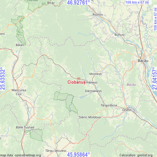
Ciobănuș GPS coordinates[2]
46° 26' 43.008" North, 26° 20' 18.384" East
| Map corner | latitude | longitude |
|---|---|---|
| Upper-left | 46.92761°, | 25.63532° |
| Center: | 46.44528°, | 26.33844° |
| Lower-right: | 45.95864°, | 27.04157° |
| Map W x H: | 107.7×107.7 km | = 66.9×66.9mi |
| max Lat: | 48.23793° ⇑34.4% North |
| Ciobănuș: | 46.44528° |
| min Lat: | ⇓65.6% South 43.65638° |
| min Long | Ciobănuș | max Long |
| 20.31667° | 26.33844° | 29.65403° |
| W 69.7%⇐ | ⇒30.3% E |
Elevation
Elevation of Ciobănuș is 458 m = 1503 ft, and this is 203.1 m = 666 ft above average elevation for this country.
| Max E: |
1278 m = 4193 ft | 13.9% |
| Ciobănuș | 458 m 1503 ft | |
| Avg. | 254.9 m = 836 ft | |
Min E: |
-2 m = -7 ft | 86.1% |
See also: Romania elevation on elevation.city.
Geographical zone
Ciobănuș is located in North temperate zone (between Tropic of Cancer and the Arctic Circle). Distance of this North polar circle is 2236.9 km =1389.9 mi to North.| Distance of | km | miles | from Ciobănuș |
|---|---|---|---|
| North Pole | 4842.8 | 3009.2 | to North |
| Arctic Circle | 2236.9 | 1389.9 | to North |
| Tropic Cancer | 2558.3 | 1589.7 | to South |
| Equator | 5164.2 | 3208.9 | to South |


Nearby cities:
15 places around Ciobănuș: (largest is in red/bold)
• Agăş
10.2 km =6.3 mi,  294°
294°
• Apa Asău
5.6 km =3.5 mi,  33°
33°
• Asău
4.9 km =3 mi,  105°
105°
• Comăneşti
8 km =5 mi, 109°
• Cotumba
12.7 km =7.9 mi,  297°
297°
• Goioasa
3.1 km =1.9 mi,  274°
274°
• Lunca Asău
5.7 km =3.5 mi,  101°
101°
• Lăpoș
11.1 km =6.9 mi,  121°
121°
• Moineşti
12 km =7.5 mi,  73°
73°
• Podei
9 km =5.6 mi, 116°
• Preluci
4.9 km =3 mi,  284°
284°
• Păltiniș
11 km =6.8 mi,  7°
7°
• Straja
1.9 km =1.2 mi, 107°
• Sulța
8 km =5 mi, 288°
• Vermești
10.9 km =6.8 mi, 103°
Sources, notices
• [Note1] Compared only with cities in Romania existing in our database
• [Src1] Map data: © OpenStreetMap contributors (CC-BY-SA)
• [Src2] Other city data from geonames.org with taken over terms of usage.
• [Src3] Geographical zone / Annual Mean Temperature by Robert A. Rohde @ Wikipedia
