Slănic-Moldova geodata
Slănic-Moldova (Bacău) is a seat of a second-order administrative division; located in Romania in Europe/Bucharest (GMT+3) time zone. With population of 4,955 people, there are 805 cities with bigger population in this country. Compared to other cities in Romania, 60.1% of cities are located further ↓South; 72.1% of cities are located further ←West and 82.9% of cities have lower elevation than Slănic-Moldova. Note1


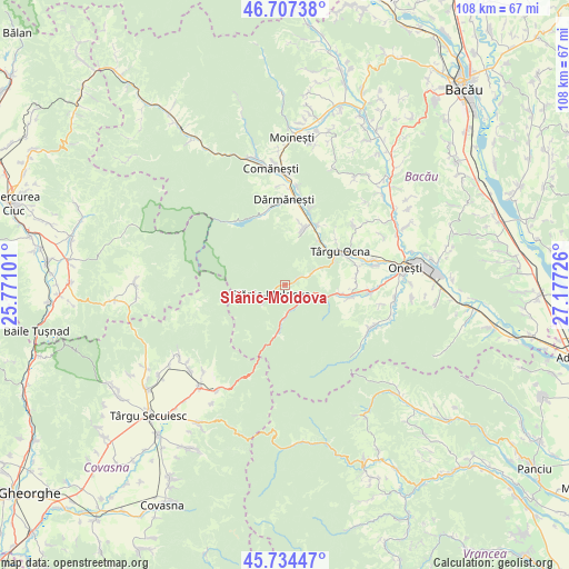
Slănic-Moldova GPS coordinates[2]
46° 13' 23.088" North, 26° 28' 26.868" East
| Map corner | latitude | longitude |
|---|---|---|
| Upper-left | 46.70738°, | 25.77101° |
| Center: | 46.22308°, | 26.47413° |
| Lower-right: | 45.73447°, | 27.17726° |
| Map W x H: | 108.2×108.2 km | = 67.2×67.2mi |
| max Lat: | 48.23793° ⇑39.9% North |
| Slănic-Moldova: | 46.22308° |
| min Lat: | ⇓60.1% South 43.65638° |
| min Long | Slănic-Moldova | max Long |
| 20.31667° | 26.47413° | 29.65403° |
| W 72.1%⇐ | ⇒27.9% E |
Elevation
Elevation of Slănic-Moldova is 422 m = 1385 ft, and this is 167.1 m = 548 ft above average elevation for this country.
| Max E: |
1278 m = 4193 ft | 17.1% |
| Slănic-Moldova | 422 m 1385 ft | |
| Avg. | 254.9 m = 836 ft | |
Min E: |
-2 m = -7 ft | 82.9% |
See also: Romania elevation on elevation.city.
Geographical zone
Slănic-Moldova is located in North temperate zone (between Tropic of Cancer and the Arctic Circle). Distance of this North polar circle is 2261.6 km =1405.3 mi to North.| Distance of | km | miles | from Slănic-Moldova |
|---|---|---|---|
| North Pole | 4867.5 | 3024.5 | to North |
| Arctic Circle | 2261.6 | 1405.3 | to North |
| Tropic Cancer | 2533.6 | 1574.3 | to South |
| Equator | 5139.5 | 3193.5 | to South |


Nearby cities:
15 places around Slănic-Moldova: (largest is in red/bold)
• Bahna
13.6 km =8.5 mi,  88°
88°
• Bogata
10.8 km =6.7 mi,  37°
37°
• Cerdac
3.6 km =2.2 mi,  63°
63°
• Cireșoaia
6.4 km =4 mi, 64°
• Cucuieți
13.2 km =8.2 mi,  28°
28°
• Dofteana
10.9 km =6.8 mi,  17°
17°
• Ferestrău-Oituz
8.2 km =5.1 mi,  106°
106°
• Hăghiac
10.5 km =6.5 mi, 18°
• Marginea
12.6 km =7.8 mi, 93°
• Nicorești
13.5 km =8.4 mi,  84°
84°
• Oituz
11.3 km =7 mi,  103°
103°
• Poieni
9.8 km =6.1 mi,  46°
46°
• Târgu Ocna
12.4 km =7.7 mi, 59°
• Vâlcele
12.8 km =8 mi, 49°
• Ștefan Vodă
10.8 km =6.7 mi, 15°
Sources, notices
• [Note1] Compared only with cities in Romania existing in our database
• [Src1] Map data: © OpenStreetMap contributors (CC-BY-SA)
• [Src2] Other city data from geonames.org with taken over terms of usage.
• [Src3] Geographical zone / Annual Mean Temperature by Robert A. Rohde @ Wikipedia
