Sântandrei geodata
Sântandrei (Bihor) is a seat of a second-order administrative division; located in Romania in Europe/Bucharest (GMT+3) time zone. With population of 3,902 people, there are 1207 cities with bigger population in this country. Compared to other cities in Romania, 80.6% of cities are located further ↓South; 95.4% of cities are located further →East and 74.5% of cities have higher elevation than Sântandrei. Note1


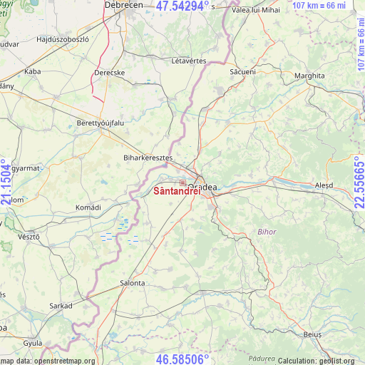
Sântandrei GPS coordinates[2]
47° 3' 58.14" North, 21° 51' 12.672" East
| Map corner | latitude | longitude |
|---|---|---|
| Upper-left | 47.54294°, | 21.1504° |
| Center: | 47.06615°, | 21.85352° |
| Lower-right: | 46.58506°, | 22.55665° |
| Map W x H: | 106.5×106.5 km | = 66.2×66.2mi |
| max Lat: | 48.23793° ⇑19.4% North |
| Sântandrei: | 47.06615° |
| min Lat: | ⇓80.6% South 43.65638° |
| min Long | Sântandrei | max Long |
| 20.31667° | 21.85352° | 29.65403° |
| W 4.6%⇐ | ⇒95.4% E |
Elevation
Elevation of Sântandrei is 112 m = 367 ft, and this is 142.9 m = 469 ft below average elevation for this country.
| Max E: |
1278 m = 4193 ft | 74.5% |
| Avg. | 254.9 m = 836 ft | |
| Sântandrei | 112 m = 367 ft | |
Min E: |
-2 m = -7 ft | 25.5% |
See also: Romania elevation on elevation.city.
Geographical zone
Sântandrei is located in North temperate zone (between Tropic of Cancer and the Arctic Circle). Distance of this North polar circle is 2167.9 km =1347.1 mi to North.| Distance of | km | miles | from Sântandrei |
|---|---|---|---|
| North Pole | 4773.8 | 2966.3 | to North |
| Arctic Circle | 2167.9 | 1347.1 | to North |
| Tropic Cancer | 2627.3 | 1632.5 | to South |
| Equator | 5233.3 | 3251.8 | to South |


Nearby cities:
15 places around Sântandrei: (largest is in red/bold)
• Biharia
10.5 km =6.5 mi,  27°
27°
• Borş
6.3 km =3.9 mi,  333°
333°
• Cauaceu
13.1 km =8.1 mi, 31°
• Cihei
10.6 km =6.6 mi,  134°
134°
• Girișu de Criș
7 km =4.3 mi,  268°
268°
• Leș
11.3 km =7 mi,  185°
185°
• Livada de Bihor
7.1 km =4.4 mi,  208°
208°
• Nojorid
9.5 km =5.9 mi,  166°
166°
• Oradea
5.4 km =3.4 mi,  114°
114°
• Paleu
9.7 km =6 mi,  55°
55°
• Sântion
3.6 km =2.2 mi,  339°
339°
• Sînmartin
11.2 km =7 mi, 125°
• Săldăbagiu de Munte
9.6 km =6 mi,  74°
74°
• Toboliu
10.5 km =6.5 mi,  255°
255°
• Uileacu de Munte
12.3 km =7.6 mi, 62°
Sources, notices
• [Note1] Compared only with cities in Romania existing in our database
• [Src1] Map data: © OpenStreetMap contributors (CC-BY-SA)
• [Src2] Other city data from geonames.org with taken over terms of usage.
• [Src3] Geographical zone / Annual Mean Temperature by Robert A. Rohde @ Wikipedia
