Sângeorgiu de Pădure geodata
Sângeorgiu de Pădure (Mureş) is a seat of a second-order administrative division; located in Romania in Europe/Bucharest (GMT+3) time zone. With population of 4,794 people, there are 842 cities with bigger population in this country. Compared to other cities in Romania, 65.3% of cities are located further ↓South; 54.8% of cities are located further →East and 73.4% of cities have lower elevation than Sângeorgiu de Pădure. Note1


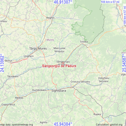
Sângeorgiu de Pădure GPS coordinates[2]
46° 25' 50.196" North, 24° 50' 33.864" East
| Map corner | latitude | longitude |
|---|---|---|
| Upper-left | 46.91307°, | 24.13962° |
| Center: | 46.43061°, | 24.84274° |
| Lower-right: | 45.94384°, | 25.54587° |
| Map W x H: | 107.8×107.8 km | = 67×67mi |
| max Lat: | 48.23793° ⇑34.7% North |
| Sângeorgiu de Pădure: | 46.43061° |
| min Lat: | ⇓65.3% South 43.65638° |
| min Long | Sângeorgiu de | max Long |
| 20.31667° | 24.84274° | 29.65403° |
| W 45.2%⇐ | ⇒54.8% E |
Elevation
Elevation of Sângeorgiu de Pădure is 342 m = 1122 ft, and this is 87.1 m = 286 ft above average elevation for this country.
| Max E: |
1278 m = 4193 ft | 26.6% |
| Sângeorgiu de Pădure | 342 m 1122 ft | |
| Avg. | 254.9 m = 836 ft | |
Min E: |
-2 m = -7 ft | 73.4% |
See also: Romania elevation on elevation.city.
Geographical zone
Sângeorgiu de Pădure is located in North temperate zone (between Tropic of Cancer and the Arctic Circle). Distance of this North polar circle is 2238.6 km =1391 mi to North.| Distance of | km | miles | from Sângeorgiu de Pădure |
|---|---|---|---|
| North Pole | 4844.5 | 3010.2 | to North |
| Arctic Circle | 2238.6 | 1391 | to North |
| Tropic Cancer | 2556.7 | 1588.7 | to South |
| Equator | 5162.6 | 3207.9 | to South |


Nearby cities:
15 places around Sângeorgiu de Pădure: (largest is in red/bold)
• Bezid
6.8 km =4.2 mi,  113°
113°
• Chendu
9.7 km =6 mi,  243°
243°
• Crișeni
10.1 km =6.3 mi,  99°
99°
• Călimănești
8.6 km =5.3 mi,  257°
257°
• Dumitreni
7.2 km =4.5 mi, 242°
• Fântânele
7.3 km =4.5 mi, 257°
• Ghindari
9.6 km =6 mi,  36°
36°
• Găleşti
11.9 km =7.4 mi,  323°
323°
• Miercurea Nirajului
11.9 km =7.4 mi,  344°
344°
• Neaua
5.9 km =3.7 mi,  352°
352°
• Păsăreni
12.4 km =7.7 mi,  298°
298°
• Trei Sate
6.6 km =4.1 mi, 40°
• Troița
8.2 km =5.1 mi, 316°
• Veţca
10.1 km =6.3 mi,  206°
206°
• Viforoasa
2.5 km =1.6 mi,  273°
273°
Sources, notices
• [Note1] Compared only with cities in Romania existing in our database
• [Src1] Map data: © OpenStreetMap contributors (CC-BY-SA)
• [Src2] Other city data from geonames.org with taken over terms of usage.
• [Src3] Geographical zone / Annual Mean Temperature by Robert A. Rohde @ Wikipedia
