Sicheviţa geodata
Sicheviţa (Caraş-Severin) is a seat of a second-order administrative division; located in Romania in Europe/Bucharest (GMT+3) time zone. With population of 2,643 people, there are 2025 cities with bigger population in this country. Compared to other cities in Romania, 78.8% of cities are located further ↑North; 95.5% of cities are located further →East and 74.5% of cities have lower elevation than Sicheviţa. Note1


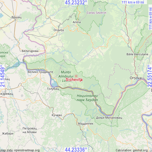
Sicheviţa GPS coordinates[2]
44° 44' 6" North, 21° 50' 54.996" East
| Map corner | latitude | longitude |
|---|---|---|
| Upper-left | 45.23232°, | 21.14549° |
| Center: | 44.735°, | 21.84861° |
| Lower-right: | 44.23336°, | 22.55174° |
| Map W x H: | 111.1×111.1 km | = 69×69mi |
| max Lat: | 48.23793° ⇑78.8% North |
| Sicheviţa: | 44.735° |
| min Lat: | ⇓21.2% South 43.65638° |
| min Long | Sicheviţa | max Long |
| 20.31667° | 21.84861° | 29.65403° |
| W 4.5%⇐ | ⇒95.5% E |
Elevation
Elevation of Sicheviţa is 349 m = 1145 ft, and this is 94.1 m = 309 ft above average elevation for this country.
| Max E: |
1278 m = 4193 ft | 25.5% |
| Sicheviţa | 349 m 1145 ft | |
| Avg. | 254.9 m = 836 ft | |
Min E: |
-2 m = -7 ft | 74.5% |
See also: Romania elevation on elevation.city.
Geographical zone
Sicheviţa is located in North temperate zone (between Tropic of Cancer and the Arctic Circle). Distance of this Northern Tropic circle is 2368.1 km =1471.5 mi to South.| Distance of | km | miles | from Sicheviţa |
|---|---|---|---|
| North Pole | 5033 | 3127.4 | to North |
| Arctic Circle | 2427.1 | 1508.1 | to North |
| Tropic Cancer | 2368.1 | 1471.5 | to South |
| Equator | 4974.1 | 3090.8 | to South |


Nearby cities:
15 places around Sicheviţa: (largest is in red/bold)
• Berzasca
12.9 km =8 mi,  139°
139°
• Coronini
14.3 km =8.9 mi,  244°
244°
• Cărbunari
13.8 km =8.6 mi,  323°
323°
• Dalboșeț
16.8 km =10.4 mi,  31°
31°
• Gornea
6.1 km =3.8 mi,  173°
173°
• Gârnic
7.1 km =4.4 mi, 323°
• Liubcova
9.2 km =5.7 mi,  156°
156°
• Moceriș
16.2 km =10.1 mi,  21°
21°
• Moldova Nouă
14.4 km =8.9 mi,  271°
271°
• Măcești
19 km =11.8 mi,  276°
276°
• Padina Matei
8.2 km =5.1 mi,  288°
288°
• Sfânta Elena
12.4 km =7.7 mi, 239°
• Şopotu Nou
11.9 km =7.4 mi,  5°
5°
• Șopotu Vechi
17.9 km =11.1 mi,  40°
40°
• Știnăpari
15.2 km =9.4 mi, 324°
Sources, notices
• [Note1] Compared only with cities in Romania existing in our database
• [Src1] Map data: © OpenStreetMap contributors (CC-BY-SA)
• [Src2] Other city data from geonames.org with taken over terms of usage.
• [Src3] Geographical zone / Annual Mean Temperature by Robert A. Rohde @ Wikipedia
