Berzasca geodata
Berzasca (Caraş-Severin) is a seat of a second-order administrative division; located in Romania in Europe/Bucharest (GMT+3) time zone. With population of 1,619 people, there are 3025 cities with bigger population in this country. Compared to other cities in Romania, 81.7% of cities are located further ↑North; 94.8% of cities are located further →East and 86.2% of cities have higher elevation than Berzasca. Note1


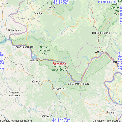
Berzasca GPS coordinates[2]
44° 38' 49.632" North, 21° 57' 15.408" East
| Map corner | latitude | longitude |
|---|---|---|
| Upper-left | 45.1452°, | 21.25116° |
| Center: | 44.64712°, | 21.95428° |
| Lower-right: | 44.14473°, | 22.65741° |
| Map W x H: | 111.2×111.2 km | = 69.1×69.1mi |
| max Lat: | 48.23793° ⇑81.7% North |
| Berzasca: | 44.64712° |
| min Lat: | ⇓18.3% South 43.65638° |
| min Long | Berzasca | max Long |
| 20.31667° | 21.95428° | 29.65403° |
| W 5.2%⇐ | ⇒94.8% E |
Elevation
Elevation of Berzasca is 74 m = 243 ft, and this is 180.9 m = 594 ft below average elevation for this country.
| Max E: |
1278 m = 4193 ft | 86.2% |
| Avg. | 254.9 m = 836 ft | |
| Berzasca | 74 m = 243 ft | |
Min E: |
-2 m = -7 ft | 13.8% |
See also: Romania elevation on elevation.city.
Geographical zone
Berzasca is located in North temperate zone (between Tropic of Cancer and the Arctic Circle). Distance of this Northern Tropic circle is 2358.4 km =1465.4 mi to South.| Distance of | km | miles | from Berzasca |
|---|---|---|---|
| North Pole | 5042.8 | 3133.4 | to North |
| Arctic Circle | 2436.9 | 1514.2 | to North |
| Tropic Cancer | 2358.4 | 1465.4 | to South |
| Equator | 4964.3 | 3084.7 | to South |


Nearby cities:
15 places around Berzasca: (largest is in red/bold)
• Coronini
21.6 km =13.4 mi,  279°
279°
• Dalboșeț
24.1 km =15 mi,  0°
0°
• Dubova
24.9 km =15.5 mi,  97°
97°
• Gornea
8.6 km =5.3 mi,  295°
295°
• Gârbovăț
24.9 km =15.5 mi,  10°
10°
• Gârnic
20 km =12.4 mi,  320°
320°
• Liubcova
4.8 km =3 mi,  285°
285°
• Moceriș
25 km =15.5 mi,  354°
354°
• Moldova Nouă
24.8 km =15.4 mi, 293°
• Padina Matei
20.3 km =12.6 mi,  307°
307°
• Sfânta Elena
19.3 km =12 mi, 280°
• Sicheviţa
12.9 km =8 mi, 319°
• Sviniţa
20.3 km =12.6 mi,  143°
143°
• Şopotu Nou
22.8 km =14.2 mi,  341°
341°
• Șopotu Vechi
23.7 km =14.7 mi, 7°
Sources, notices
• [Note1] Compared only with cities in Romania existing in our database
• [Src1] Map data: © OpenStreetMap contributors (CC-BY-SA)
• [Src2] Other city data from geonames.org with taken over terms of usage.
• [Src3] Geographical zone / Annual Mean Temperature by Robert A. Rohde @ Wikipedia
