Sfânta Elena geodata
Sfânta Elena (Caraş-Severin) is a populated place; located in Romania in Europe/Bucharest (GMT+3) time zone. With population of 737 people, there are 5354 cities with bigger population in this country. Compared to other cities in Romania, 80.8% of cities are located further ↑North; 96.4% of cities are located further →East and 67.6% of cities have lower elevation than Sfânta Elena. Note1


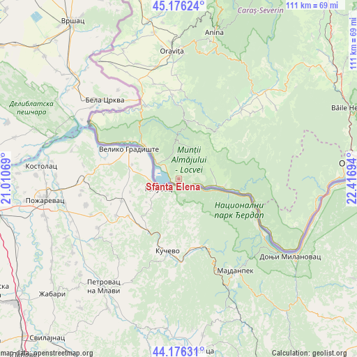
Sfânta Elena GPS coordinates[2]
44° 40' 42.348" North, 21° 42' 49.716" East
| Map corner | latitude | longitude |
|---|---|---|
| Upper-left | 45.17624°, | 21.01069° |
| Center: | 44.67843°, | 21.71381° |
| Lower-right: | 44.17631°, | 22.41694° |
| Map W x H: | 111.2×111.2 km | = 69.1×69.1mi |
| max Lat: | 48.23793° ⇑80.8% North |
| Sfânta Elena: | 44.67843° |
| min Lat: | ⇓19.2% South 43.65638° |
| min Long | Sfânta Elena | max Long |
| 20.31667° | 21.71381° | 29.65403° |
| W 3.6%⇐ | ⇒96.4% E |
Elevation
Elevation of Sfânta Elena is 305 m = 1001 ft, and this is 50.1 m = 164 ft above average elevation for this country.
| Max E: |
1278 m = 4193 ft | 32.4% |
| Sfânta Elena | 305 m 1001 ft | |
| Avg. | 254.9 m = 836 ft | |
Min E: |
-2 m = -7 ft | 67.6% |
See also: Romania elevation on elevation.city.
Geographical zone
Sfânta Elena is located in North temperate zone (between Tropic of Cancer and the Arctic Circle). Distance of this Northern Tropic circle is 2361.9 km =1467.6 mi to South.| Distance of | km | miles | from Sfânta Elena |
|---|---|---|---|
| North Pole | 5039.3 | 3131.3 | to North |
| Arctic Circle | 2433.4 | 1512 | to North |
| Tropic Cancer | 2361.9 | 1467.6 | to South |
| Equator | 4967.8 | 3086.8 | to South |


Nearby cities:
15 places around Sfânta Elena: (largest is in red/bold)
• Belobreșca
20 km =12.4 mi,  307°
307°
• Berzasca
19.3 km =12 mi,  100°
100°
• Coronini
2.2 km =1.4 mi,  274°
274°
• Cărbunari
17.5 km =10.9 mi,  7°
7°
• Gornea
11.3 km =7 mi,  88°
88°
• Gârnic
13.6 km =8.5 mi,  27°
27°
• Liubcova
14.5 km =9 mi, 98°
• Moldova Nouă
7.5 km =4.7 mi,  330°
330°
• Măcești
11.9 km =7.4 mi,  315°
315°
• Padina Matei
9.4 km =5.8 mi,  18°
18°
• Pojejena
15 km =9.3 mi, 315°
• Radimna
17.6 km =10.9 mi, 317°
• Sicheviţa
12.4 km =7.7 mi,  59°
59°
• Știnăpari
18.7 km =11.6 mi, 5°
• Șușca
18.6 km =11.6 mi, 309°
Sources, notices
• [Note1] Compared only with cities in Romania existing in our database
• [Src1] Map data: © OpenStreetMap contributors (CC-BY-SA)
• [Src2] Other city data from geonames.org with taken over terms of usage.
• [Src3] Geographical zone / Annual Mean Temperature by Robert A. Rohde @ Wikipedia
