Şendriceni geodata
Şendriceni (Botoşani) is a seat of a second-order administrative division; located in Romania in Europe/Bucharest (GMT+3) time zone. With population of 4,200 people, there are 1094 cities with bigger population in this country. Compared to other cities in Romania, 98.8% of cities are located further ↓South; 69.4% of cities are located further ←West and 51% of cities have lower elevation than Şendriceni. Note1


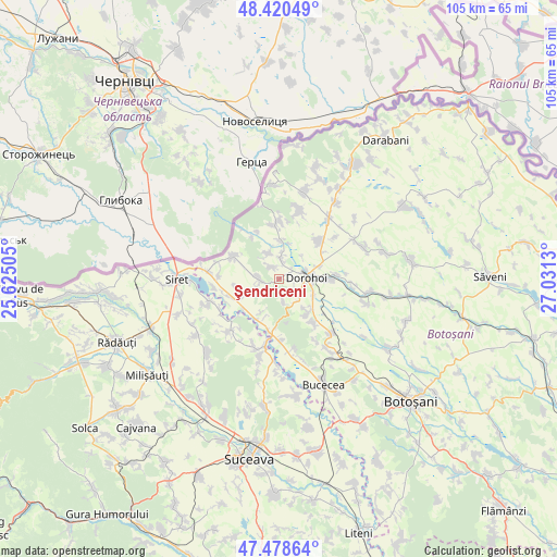
Şendriceni GPS coordinates[2]
47° 57' 6.156" North, 26° 19' 41.412" East
| Map corner | latitude | longitude |
|---|---|---|
| Upper-left | 48.42049°, | 25.62505° |
| Center: | 47.95171°, | 26.32817° |
| Lower-right: | 47.47864°, | 27.0313° |
| Map W x H: | 104.7×104.7 km | = 65.1×65.1mi |
| max Lat: | 48.23793° ⇑1.2% North |
| Şendriceni: | 47.95171° |
| min Lat: | ⇓98.8% South 43.65638° |
| min Long | Şendriceni | max Long |
| 20.31667° | 26.32817° | 29.65403° |
| W 69.4%⇐ | ⇒30.6% E |
Elevation
Elevation of Şendriceni is 217 m = 712 ft, and this is 37.9 m = 124 ft below average elevation for this country.
| Max E: |
1278 m = 4193 ft | 49% |
| Avg. | 254.9 m = 836 ft | |
| Şendriceni | 217 m = 712 ft | |
Min E: |
-2 m = -7 ft | 51% |
See also: Romania elevation on elevation.city.
Geographical zone
Şendriceni is located in North temperate zone (between Tropic of Cancer and the Arctic Circle). Distance of this North polar circle is 2069.4 km =1285.9 mi to North.| Distance of | km | miles | from Şendriceni |
|---|---|---|---|
| North Pole | 4675.3 | 2905.1 | to North |
| Arctic Circle | 2069.4 | 1285.9 | to North |
| Tropic Cancer | 2725.8 | 1693.7 | to South |
| Equator | 5331.7 | 3313 | to South |


Nearby cities:
15 places around Şendriceni: (largest is in red/bold)
• Broscăuţi
9.1 km =5.7 mi,  91°
91°
• Corjăuți
9.9 km =6.2 mi,  336°
336°
• Cândeşti
9.8 km =6.1 mi,  257°
257°
• Dersca
10.2 km =6.3 mi,  290°
290°
• Dorohoi
5.4 km =3.4 mi, 92°
• Dumbrăvița
10.5 km =6.5 mi,  44°
44°
• Hilișeu-Cloșca
7.1 km =4.4 mi,  3°
3°
• Iezer
3.5 km =2.2 mi,  6°
6°
• Lozna
3.8 km =2.4 mi,  269°
269°
• Lunca
8.7 km =5.4 mi,  208°
208°
• Pădureni
2.7 km =1.7 mi, 341°
• Saucenița
8.2 km =5.1 mi,  141°
141°
• Străteni
2.9 km =1.8 mi,  234°
234°
• Talpa
8.8 km =5.5 mi, 231°
• Văculeşti
10.1 km =6.3 mi, 139°
Sources, notices
• [Note1] Compared only with cities in Romania existing in our database
• [Src1] Map data: © OpenStreetMap contributors (CC-BY-SA)
• [Src2] Other city data from geonames.org with taken over terms of usage.
• [Src3] Geographical zone / Annual Mean Temperature by Robert A. Rohde @ Wikipedia
