Pădureni geodata
Pădureni (Botoşani) is a populated place; located in Romania in Europe/Bucharest (GMT+3) time zone. With population of 1,125 people, there are 3919 cities with bigger population in this country. Compared to other cities in Romania, 99% of cities are located further ↓South; 69.2% of cities are located further ←West and 56.6% of cities have higher elevation than Pădureni. Note1


Pădureni GPS coordinates[2]
47° 58' 27.624" North, 26° 19' 0.192" East
| Map corner | latitude | longitude |
|---|---|---|
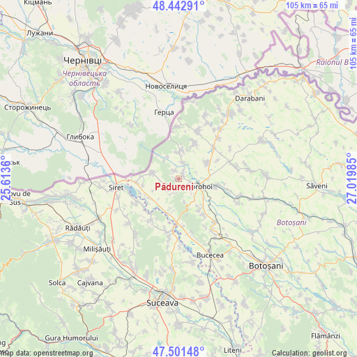
| Upper-left | 48.44291°, | 25.6136° |
| Center: | 47.97434°, | 26.31672° |
| Lower-right: | 47.50148°, | 27.01985° |
| Map W x H: | 104.7×104.7 km | = 65.1×65.1mi |
| max Lat: | 48.23793° ⇑1% North |
| Pădureni: | 47.97434° |
| min Lat: | ⇓99% South 43.65638° |
| min Long | Pădureni | max Long |
| 20.31667° | 26.31672° | 29.65403° |
| W 69.2%⇐ | ⇒30.8% E |
Elevation
Elevation of Pădureni is 180 m = 591 ft, and this is 74.9 m = 246 ft below average elevation for this country.
| Max E: |
1278 m = 4193 ft | 56.6% |
| Avg. | 254.9 m = 836 ft | |
| Pădureni | 180 m = 591 ft | |
Min E: |
-2 m = -7 ft | 43.4% |
See also: Romania elevation on elevation.city.
Geographical zone
Pădureni is located in North temperate zone (between Tropic of Cancer and the Arctic Circle). Distance of this North polar circle is 2066.9 km =1284.3 mi to North.| Distance of | km | miles | from Pădureni |
|---|---|---|---|
| North Pole | 4672.8 | 2903.5 | to North |
| Arctic Circle | 2066.9 | 1284.3 | to North |
| Tropic Cancer | 2728.3 | 1695.3 | to South |
| Equator | 5334.2 | 3314.5 | to South |


Nearby cities:
15 places around Pădureni: (largest is in red/bold)
• Broscăuţi
10.3 km =6.4 mi,  105°
105°
• Corjăuți
7.3 km =4.5 mi,  334°
334°
• Cândeşti
9.8 km =6.1 mi,  242°
242°
• Dersca
8.7 km =5.4 mi,  276°
276°
• Dorohoi
6.8 km =4.2 mi, 113°
• Dumbrăvița
9.6 km =6 mi,  58°
58°
• Hilişeu-Horia
8.2 km =5.1 mi,  322°
322°
• Hilișeu-Cloșca
4.7 km =2.9 mi,  16°
16°
• Hilișeu-Crișan
9.1 km =5.7 mi, 319°
• Iezer
1.6 km =1 mi,  51°
51°
• Lozna
3.9 km =2.4 mi,  229°
229°
• Pomârla
10.3 km =6.4 mi,  359°
359°
• Străteni
4.4 km =2.7 mi,  199°
199°
• Talpa
10 km =6.2 mi,  216°
216°
• Şendriceni
2.7 km =1.7 mi,  161°
161°
Sources, notices
• [Note1] Compared only with cities in Romania existing in our database
• [Src1] Map data: © OpenStreetMap contributors (CC-BY-SA)
• [Src2] Other city data from geonames.org with taken over terms of usage.
• [Src3] Geographical zone / Annual Mean Temperature by Robert A. Rohde @ Wikipedia
