Saucenița geodata
Saucenița (Botoşani) is a populated place; located in Romania in Europe/Bucharest (GMT+3) time zone. With population of 932 people, there are 4506 cities with bigger population in this country. Compared to other cities in Romania, 97.9% of cities are located further ↓South; 70.8% of cities are located further ←West and 51.6% of cities have higher elevation than Saucenița. Note1


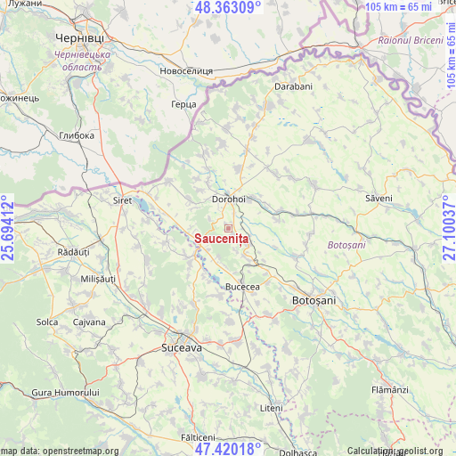
Saucenița GPS coordinates[2]
47° 53' 37.608" North, 26° 23' 50.064" East
| Map corner | latitude | longitude |
|---|---|---|
| Upper-left | 48.36309°, | 25.69412° |
| Center: | 47.89378°, | 26.39724° |
| Lower-right: | 47.42018°, | 27.10037° |
| Map W x H: | 104.8×104.8 km | = 65.1×65.1mi |
| max Lat: | 48.23793° ⇑2.1% North |
| Saucenița: | 47.89378° |
| min Lat: | ⇓97.9% South 43.65638° |
| min Long | Saucenița | max Long |
| 20.31667° | 26.39724° | 29.65403° |
| W 70.8%⇐ | ⇒29.2% E |
Elevation
Elevation of Saucenița is 203 m = 666 ft, and this is 51.9 m = 170 ft below average elevation for this country.
| Max E: |
1278 m = 4193 ft | 51.6% |
| Avg. | 254.9 m = 836 ft | |
| Saucenița | 203 m = 666 ft | |
Min E: |
-2 m = -7 ft | 48.4% |
See also: Romania elevation on elevation.city.
Geographical zone
Saucenița is located in North temperate zone (between Tropic of Cancer and the Arctic Circle). Distance of this North polar circle is 2075.9 km =1289.9 mi to North.| Distance of | km | miles | from Saucenița |
|---|---|---|---|
| North Pole | 4681.8 | 2909.1 | to North |
| Arctic Circle | 2075.9 | 1289.9 | to North |
| Tropic Cancer | 2719.4 | 1689.8 | to South |
| Equator | 5325.3 | 3309 | to South |


Nearby cities:
15 places around Saucenița: (largest is in red/bold)
• Broscăuţi
7.4 km =4.6 mi,  32°
32°
• Brăeşti
5 km =3.1 mi,  127°
127°
• Bucovineni
6.8 km =4.2 mi,  224°
224°
• Carasa
10.6 km =6.6 mi,  59°
59°
• Dolina
8.7 km =5.4 mi,  147°
147°
• Dorohoi
6.3 km =3.9 mi,  1°
1°
• Ionășeni
9 km =5.6 mi,  184°
184°
• Leorda
9.4 km =5.8 mi,  155°
155°
• Lunca
9.4 km =5.8 mi,  262°
262°
• Poiana
5.8 km =3.6 mi, 159°
• Străteni
8.9 km =5.5 mi,  302°
302°
• Vârfu Câmpului
7.3 km =4.5 mi, 222°
• Văculeşti
1.9 km =1.2 mi, 128°
• Zvoriştea
10.8 km =6.7 mi,  231°
231°
• Şendriceni
8.2 km =5.1 mi,  321°
321°
Sources, notices
• [Note1] Compared only with cities in Romania existing in our database
• [Src1] Map data: © OpenStreetMap contributors (CC-BY-SA)
• [Src2] Other city data from geonames.org with taken over terms of usage.
• [Src3] Geographical zone / Annual Mean Temperature by Robert A. Rohde @ Wikipedia
