Săveni geodata
Săveni (Botoşani) is a seat of a second-order administrative division; located in Romania in Europe/Bucharest (GMT+3) time zone. With population of 8,126 people, there are 301 cities with bigger population in this country. Compared to other cities in Romania, 98.6% of cities are located further ↓South; 80.1% of cities are located further ←West and 83.5% of cities have higher elevation than Săveni. Note1


Săveni GPS coordinates[2]
47° 57' 0" North, 26° 52' 0.012" East
| Map corner | latitude | longitude |
|---|---|---|
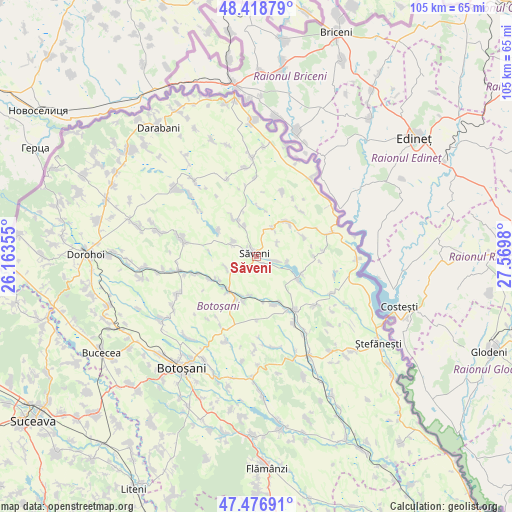
| Upper-left | 48.41879°, | 26.16355° |
| Center: | 47.95°, | 26.86667° |
| Lower-right: | 47.47691°, | 27.5698° |
| Map W x H: | 104.7×104.7 km | = 65.1×65.1mi |
| max Lat: | 48.23793° ⇑1.4% North |
| Săveni: | 47.95° |
| min Lat: | ⇓98.6% South 43.65638° |
| min Long | Săveni | max Long |
| 20.31667° | 26.86667° | 29.65403° |
| W 80.1%⇐ | ⇒19.9% E |
Elevation
Elevation of Săveni is 83 m = 272 ft, and this is 171.9 m = 564 ft below average elevation for this country.
| Max E: |
1278 m = 4193 ft | 83.5% |
| Avg. | 254.9 m = 836 ft | |
| Săveni | 83 m = 272 ft | |
Min E: |
-2 m = -7 ft | 16.5% |
See also: Romania elevation on elevation.city.
Geographical zone
Săveni is located in North temperate zone (between Tropic of Cancer and the Arctic Circle). Distance of this North polar circle is 2069.6 km =1286 mi to North.| Distance of | km | miles | from Săveni |
|---|---|---|---|
| North Pole | 4675.5 | 2905.2 | to North |
| Arctic Circle | 2069.6 | 1286 | to North |
| Tropic Cancer | 2725.6 | 1693.6 | to South |
| Equator | 5331.5 | 3312.8 | to South |


Nearby cities:
15 places around Săveni: (largest is in red/bold)
• Aurel Vlaicu
6.6 km =4.1 mi,  30°
30°
• Borzești
9.4 km =5.8 mi,  242°
242°
• Chișcăreni
2.9 km =1.8 mi,  296°
296°
• Drăguşeni
8.3 km =5.2 mi,  333°
333°
• Hăneşti
9.4 km =5.8 mi,  113°
113°
• Mihai Viteazu
6.7 km =4.2 mi,  249°
249°
• Negreni
9.6 km =6 mi, 304°
• Petricani
1.9 km =1.2 mi,  292°
292°
• Plopenii Mari
8.7 km =5.4 mi,  220°
220°
• Podriga
6.6 km =4.1 mi,  338°
338°
• Sârbi
3.9 km =2.4 mi,  101°
101°
• Ungureni
9.1 km =5.7 mi,  213°
213°
• Vicoleni
7.9 km =4.9 mi,  189°
189°
• Vlăsineşti
2.2 km =1.4 mi,  146°
146°
• Ştiubieni
6.5 km =4 mi, 286°
Sources, notices
• [Note1] Compared only with cities in Romania existing in our database
• [Src1] Map data: © OpenStreetMap contributors (CC-BY-SA)
• [Src2] Other city data from geonames.org with taken over terms of usage.
• [Src3] Geographical zone / Annual Mean Temperature by Robert A. Rohde @ Wikipedia
