Hăneşti geodata
Hăneşti (Botoşani) is a seat of a second-order administrative division; located in Romania in Europe/Bucharest (GMT+3) time zone. With population of 2,339 people, there are 2279 cities with bigger population in this country. Compared to other cities in Romania, 98.2% of cities are located further ↓South; 82.6% of cities are located further ←West and 86.1% of cities have higher elevation than Hăneşti. Note1


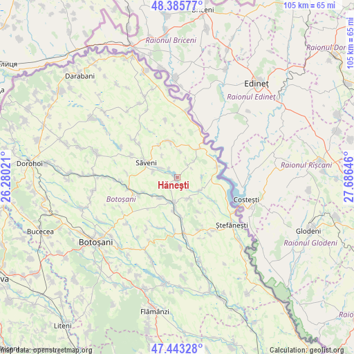
Hăneşti GPS coordinates[2]
47° 55' 0.012" North, 26° 58' 59.988" East
| Map corner | latitude | longitude |
|---|---|---|
| Upper-left | 48.38577°, | 26.28021° |
| Center: | 47.91667°, | 26.98333° |
| Lower-right: | 47.44328°, | 27.68646° |
| Map W x H: | 104.8×104.8 km | = 65.1×65.1mi |
| max Lat: | 48.23793° ⇑1.8% North |
| Hăneşti: | 47.91667° |
| min Lat: | ⇓98.2% South 43.65638° |
| min Long | Hăneşti | max Long |
| 20.31667° | 26.98333° | 29.65403° |
| W 82.6%⇐ | ⇒17.4% E |
Elevation
Elevation of Hăneşti is 75 m = 246 ft, and this is 179.9 m = 590 ft below average elevation for this country.
| Max E: |
1278 m = 4193 ft | 86.1% |
| Avg. | 254.9 m = 836 ft | |
| Hăneşti | 75 m = 246 ft | |
Min E: |
-2 m = -7 ft | 13.9% |
See also: Romania elevation on elevation.city.
Geographical zone
Hăneşti is located in North temperate zone (between Tropic of Cancer and the Arctic Circle). Distance of this North polar circle is 2073.3 km =1288.3 mi to North.| Distance of | km | miles | from Hăneşti |
|---|---|---|---|
| North Pole | 4679.2 | 2907.5 | to North |
| Arctic Circle | 2073.3 | 1288.3 | to North |
| Tropic Cancer | 2721.9 | 1691.3 | to South |
| Equator | 5327.8 | 3310.5 | to South |


Nearby cities:
15 places around Hăneşti: (largest is in red/bold)
• Aurel Vlaicu
10.8 km =6.7 mi,  330°
330°
• Brăteni
6.8 km =4.2 mi,  155°
155°
• Dângeni
7.5 km =4.7 mi,  189°
189°
• Flondora
10.3 km =6.4 mi,  20°
20°
• Hulub
10.2 km =6.3 mi, 187°
• Iacobeni
8.1 km =5 mi,  220°
220°
• Manoleasa
9.7 km =6 mi,  39°
39°
• Mihălăşeni
7.2 km =4.5 mi,  120°
120°
• Petricani
11.3 km =7 mi,  293°
293°
• Sârbi
5.7 km =3.5 mi,  300°
300°
• Săveni
9.4 km =5.8 mi, 293°
• Tudor Vladimirescu
7.8 km =4.8 mi,  7°
7°
• Vicoleni
10.9 km =6.8 mi,  247°
247°
• Vlăsineşti
7.7 km =4.8 mi,  283°
283°
• Zahoreni
7.1 km =4.4 mi, 44°
Sources, notices
• [Note1] Compared only with cities in Romania existing in our database
• [Src1] Map data: © OpenStreetMap contributors (CC-BY-SA)
• [Src2] Other city data from geonames.org with taken over terms of usage.
• [Src3] Geographical zone / Annual Mean Temperature by Robert A. Rohde @ Wikipedia
