Şăulia geodata
Şăulia (Mureş) is a seat of a second-order administrative division; located in Romania in Europe/Bucharest (GMT+3) time zone. With population of 2,083 people, there are 2531 cities with bigger population in this country. Compared to other cities in Romania, 70.1% of cities are located further ↓South; 65.7% of cities are located further →East and 77.3% of cities have lower elevation than Şăulia. Note1


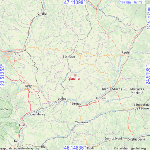
Şăulia GPS coordinates[2]
46° 37' 59.988" North, 24° 13' 0.012" East
| Map corner | latitude | longitude |
|---|---|---|
| Upper-left | 47.11399°, | 23.51355° |
| Center: | 46.63333°, | 24.21667° |
| Lower-right: | 46.14836°, | 24.9198° |
| Map W x H: | 107.4×107.4 km | = 66.7×66.7mi |
| max Lat: | 48.23793° ⇑29.9% North |
| Şăulia: | 46.63333° |
| min Lat: | ⇓70.1% South 43.65638° |
| min Long | Şăulia | max Long |
| 20.31667° | 24.21667° | 29.65403° |
| W 34.3%⇐ | ⇒65.7% E |
Elevation
Elevation of Şăulia is 370 m = 1214 ft, and this is 115.1 m = 378 ft above average elevation for this country.
| Max E: |
1278 m = 4193 ft | 22.7% |
| Şăulia | 370 m 1214 ft | |
| Avg. | 254.9 m = 836 ft | |
Min E: |
-2 m = -7 ft | 77.3% |
See also: Romania elevation on elevation.city.
Geographical zone
Şăulia is located in North temperate zone (between Tropic of Cancer and the Arctic Circle). Distance of this North polar circle is 2216 km =1377 mi to North.| Distance of | km | miles | from Şăulia |
|---|---|---|---|
| North Pole | 4821.9 | 2996.2 | to North |
| Arctic Circle | 2216 | 1377 | to North |
| Tropic Cancer | 2579.2 | 1602.6 | to South |
| Equator | 5185.1 | 3221.9 | to South |


Nearby cities:
15 places around Şăulia: (largest is in red/bold)
• Bârza
11.2 km =7 mi,  214°
214°
• Cipăieni
11.8 km =7.3 mi,  198°
198°
• Grebenişu de Câmpie
7.4 km =4.6 mi,  120°
120°
• Iclănzel
12.2 km =7.6 mi,  155°
155°
• Miheşu de Câmpie
7.5 km =4.7 mi,  317°
317°
• Papiu Ilarian
9.4 km =5.8 mi,  187°
187°
• Poduri
11.6 km =7.2 mi,  260°
260°
• Pogăceaua
8.4 km =5.2 mi,  48°
48°
• Răzoare
6.8 km =4.2 mi,  345°
345°
• Sânger
10.3 km =6.4 mi,  215°
215°
• Sânpetru de Câmpie
9.8 km =6.1 mi,  20°
20°
• Tușinu
11.1 km =6.9 mi,  4°
4°
• Tăureni
12 km =7.5 mi,  240°
240°
• Valea Largă
10.7 km =6.6 mi, 263°
• Zau de Câmpie
6.9 km =4.3 mi,  251°
251°
Sources, notices
• [Note1] Compared only with cities in Romania existing in our database
• [Src1] Map data: © OpenStreetMap contributors (CC-BY-SA)
• [Src2] Other city data from geonames.org with taken over terms of usage.
• [Src3] Geographical zone / Annual Mean Temperature by Robert A. Rohde @ Wikipedia
