Rozavlea geodata
Rozavlea (Maramureş) is a seat of a second-order administrative division; located in Romania in Europe/Bucharest (GMT+3) time zone. With population of 6,076 people, there are 532 cities with bigger population in this country. Compared to other cities in Romania, 95.4% of cities are located further ↓South; 65.7% of cities are located further →East and 75.9% of cities have lower elevation than Rozavlea. Note1


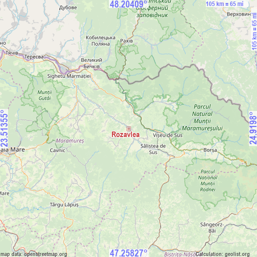
Rozavlea GPS coordinates[2]
47° 43' 59.988" North, 24° 13' 0.012" East
| Map corner | latitude | longitude |
|---|---|---|
| Upper-left | 48.20409°, | 23.51355° |
| Center: | 47.73333°, | 24.21667° |
| Lower-right: | 47.25827°, | 24.9198° |
| Map W x H: | 105.2×105.2 km | = 65.4×65.4mi |
| max Lat: | 48.23793° ⇑4.6% North |
| Rozavlea: | 47.73333° |
| min Lat: | ⇓95.4% South 43.65638° |
| min Long | Rozavlea | max Long |
| 20.31667° | 24.21667° | 29.65403° |
| W 34.3%⇐ | ⇒65.7% E |
Elevation
Elevation of Rozavlea is 360 m = 1181 ft, and this is 105.1 m = 345 ft above average elevation for this country.
| Max E: |
1278 m = 4193 ft | 24.1% |
| Rozavlea | 360 m 1181 ft | |
| Avg. | 254.9 m = 836 ft | |
Min E: |
-2 m = -7 ft | 75.9% |
See also: Romania elevation on elevation.city.
Geographical zone
Rozavlea is located in North temperate zone (between Tropic of Cancer and the Arctic Circle). Distance of this North polar circle is 2093.7 km =1301 mi to North.| Distance of | km | miles | from Rozavlea |
|---|---|---|---|
| North Pole | 4699.6 | 2920.2 | to North |
| Arctic Circle | 2093.7 | 1301 | to North |
| Tropic Cancer | 2701.5 | 1678.6 | to South |
| Equator | 5307.4 | 3297.9 | to South |


Nearby cities:
15 places around Rozavlea: (largest is in red/bold)
• Bocicoel
8.7 km =5.4 mi,  117°
117°
• Bogdan Vodă
5.9 km =3.7 mi,  141°
141°
• Botiza
8.9 km =5.5 mi,  213°
213°
• Crasna Vișeului
10.6 km =6.6 mi,  5°
5°
• Dragomireşti
9.1 km =5.7 mi, 142°
• Ieud
6.3 km =3.9 mi,  168°
168°
• Leordina
6.1 km =3.8 mi,  24°
24°
• Petrova
10.7 km =6.6 mi,  359°
359°
• Poienile Izei
8.3 km =5.2 mi,  243°
243°
• Ruscova
8.4 km =5.2 mi,  37°
37°
• Slătioara
9.5 km =5.9 mi,  284°
284°
• Strâmtura
8.3 km =5.2 mi,  311°
311°
• Săliştea de Sus
13.6 km =8.5 mi,  132°
132°
• Vişeu de Jos
11.2 km =7 mi,  94°
94°
• Șieu
1.1 km =0.7 mi,  150°
150°
Sources, notices
• [Note1] Compared only with cities in Romania existing in our database
• [Src1] Map data: © OpenStreetMap contributors (CC-BY-SA)
• [Src2] Other city data from geonames.org with taken over terms of usage.
• [Src3] Geographical zone / Annual Mean Temperature by Robert A. Rohde @ Wikipedia
