Rogova geodata
Rogova (Mehedinţi) is a seat of a second-order administrative division; located in Romania in Europe/Bucharest (GMT+3) time zone. With population of 1,464 people, there are 3238 cities with bigger population in this country. Compared to other cities in Romania, 86% of cities are located further ↑North; 87% of cities are located further →East and 75.1% of cities have higher elevation than Rogova. Note1


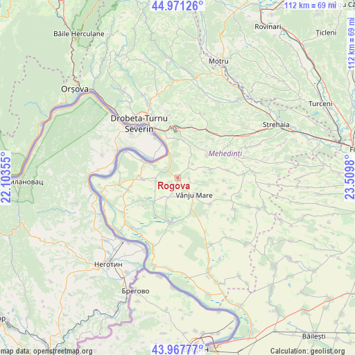
Rogova GPS coordinates[2]
44° 28' 18.012" North, 22° 48' 24.012" East
| Map corner | latitude | longitude |
|---|---|---|
| Upper-left | 44.97126°, | 22.10355° |
| Center: | 44.47167°, | 22.80667° |
| Lower-right: | 43.96777°, | 23.5098° |
| Map W x H: | 111.6×111.6 km | = 69.3×69.3mi |
| max Lat: | 48.23793° ⇑86% North |
| Rogova: | 44.47167° |
| min Lat: | ⇓14% South 43.65638° |
| min Long | Rogova | max Long |
| 20.31667° | 22.80667° | 29.65403° |
| W 13%⇐ | ⇒87% E |
Elevation
Elevation of Rogova is 110 m = 361 ft, and this is 144.9 m = 475 ft below average elevation for this country.
| Max E: |
1278 m = 4193 ft | 75.1% |
| Avg. | 254.9 m = 836 ft | |
| Rogova | 110 m = 361 ft | |
Min E: |
-2 m = -7 ft | 24.9% |
See also: Romania elevation on elevation.city.
Geographical zone
Rogova is located in North temperate zone (between Tropic of Cancer and the Arctic Circle). Distance of this Northern Tropic circle is 2338.9 km =1453.3 mi to South.| Distance of | km | miles | from Rogova |
|---|---|---|---|
| North Pole | 5062.3 | 3145.6 | to North |
| Arctic Circle | 2456.4 | 1526.3 | to North |
| Tropic Cancer | 2338.9 | 1453.3 | to South |
| Equator | 4944.8 | 3072.6 | to South |


Nearby cities:
15 places around Rogova: (largest is in red/bold)
• Bistrița
12.7 km =7.9 mi,  353°
353°
• Cioroboreni
9.8 km =6.1 mi,  200°
200°
• Corlăţel
12.9 km =8 mi,  128°
128°
• Devesel
11.1 km =6.9 mi,  268°
268°
• Hinova
8 km =5 mi,  342°
342°
• Jiana
10.8 km =6.7 mi,  223°
223°
• Jiana Mare
11.5 km =7.1 mi,  234°
234°
• Livezile
6.4 km =4 mi,  44°
44°
• Nicolae Bălcescu
11.6 km =7.2 mi,  159°
159°
• Orevița Mare
8.6 km =5.3 mi,  100°
100°
• Poroina Mare
10.6 km =6.6 mi,  75°
75°
• Scăpău
6.6 km =4.1 mi,  262°
262°
• Traian
4.3 km =2.7 mi,  108°
108°
• Vânju-Mare
7.2 km =4.5 mi,  135°
135°
• Vânjuleţ
3.6 km =2.2 mi, 198°
Sources, notices
• [Note1] Compared only with cities in Romania existing in our database
• [Src1] Map data: © OpenStreetMap contributors (CC-BY-SA)
• [Src2] Other city data from geonames.org with taken over terms of usage.
• [Src3] Geographical zone / Annual Mean Temperature by Robert A. Rohde @ Wikipedia
