Cioroboreni geodata
Cioroboreni (Mehedinţi) is a populated place; located in Romania in Europe/Bucharest (GMT+3) time zone. With population of 1,020 people, there are 4223 cities with bigger population in this country. Compared to other cities in Romania, 88.4% of cities are located further ↑North; 87.6% of cities are located further →East and 82.8% of cities have higher elevation than Cioroboreni. Note1


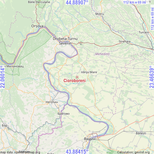
Cioroboreni GPS coordinates[2]
44° 23' 19.572" North, 22° 45' 47.736" East
| Map corner | latitude | longitude |
|---|---|---|
| Upper-left | 44.88907°, | 22.06014° |
| Center: | 44.38877°, | 22.76326° |
| Lower-right: | 43.88415°, | 23.46639° |
| Map W x H: | 111.7×111.7 km | = 69.4×69.4mi |
| max Lat: | 48.23793° ⇑88.4% North |
| Cioroboreni: | 44.38877° |
| min Lat: | ⇓11.6% South 43.65638° |
| min Long | Cioroboreni | max Long |
| 20.31667° | 22.76326° | 29.65403° |
| W 12.4%⇐ | ⇒87.6% E |
Elevation
Elevation of Cioroboreni is 85 m = 279 ft, and this is 169.9 m = 557 ft below average elevation for this country.
| Max E: |
1278 m = 4193 ft | 82.8% |
| Avg. | 254.9 m = 836 ft | |
| Cioroboreni | 85 m = 279 ft | |
Min E: |
-2 m = -7 ft | 17.2% |
See also: Romania elevation on elevation.city.
Geographical zone
Cioroboreni is located in North temperate zone (between Tropic of Cancer and the Arctic Circle). Distance of this Northern Tropic circle is 2329.6 km =1447.5 mi to South.| Distance of | km | miles | from Cioroboreni |
|---|---|---|---|
| North Pole | 5071.5 | 3151.3 | to North |
| Arctic Circle | 2465.6 | 1532.1 | to North |
| Tropic Cancer | 2329.6 | 1447.5 | to South |
| Equator | 4935.6 | 3066.8 | to South |


Nearby cities:
15 places around Cioroboreni: (largest is in red/bold)
• Devesel
11.7 km =7.3 mi,  319°
319°
• Dănceu
4.3 km =2.7 mi,  230°
230°
• Izvoarele
11.9 km =7.4 mi,  222°
222°
• Jiana
4.3 km =2.7 mi,  289°
289°
• Jiana Mare
6.4 km =4 mi, 292°
• Jiana Veche
7.5 km =4.7 mi,  271°
271°
• Nicolae Bălcescu
7.7 km =4.8 mi,  102°
102°
• Pătulele
4.9 km =3 mi,  171°
171°
• Rogova
9.8 km =6.1 mi,  20°
20°
• Scăpău
9 km =5.6 mi,  339°
339°
• Traian
10.9 km =6.8 mi,  43°
43°
• Valea Anilor
13 km =8.1 mi, 101°
• Viașu
6.3 km =3.9 mi,  127°
127°
• Vânju-Mare
9.4 km =5.8 mi,  64°
64°
• Vânjuleţ
6.3 km =3.9 mi, 21°
Sources, notices
• [Note1] Compared only with cities in Romania existing in our database
• [Src1] Map data: © OpenStreetMap contributors (CC-BY-SA)
• [Src2] Other city data from geonames.org with taken over terms of usage.
• [Src3] Geographical zone / Annual Mean Temperature by Robert A. Rohde @ Wikipedia
