Remetea geodata
Remetea (Harghita) is a seat of a second-order administrative division; located in Romania in Europe/Bucharest (GMT+3) time zone. With population of 6,225 people, there are 507 cities with bigger population in this country. Compared to other cities in Romania, 73.6% of cities are located further ↓South; 53.7% of cities are located further ←West and 97.1% of cities have lower elevation than Remetea. Note1


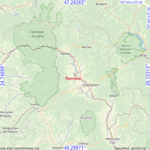
Remetea GPS coordinates[2]
46° 46' 59.988" North, 25° 27' 0" East
| Map corner | latitude | longitude |
|---|---|---|
| Upper-left | 47.26265°, | 24.74688° |
| Center: | 46.78333°, | 25.45° |
| Lower-right: | 46.29971°, | 26.15313° |
| Map W x H: | 107.1×107.1 km | = 66.5×66.5mi |
| max Lat: | 48.23793° ⇑26.4% North |
| Remetea: | 46.78333° |
| min Lat: | ⇓73.6% South 43.65638° |
| min Long | Remetea | max Long |
| 20.31667° | 25.45° | 29.65403° |
| W 53.7%⇐ | ⇒46.3% E |
Elevation
Elevation of Remetea is 724 m = 2375 ft, and this is 469.1 m = 1539 ft above average elevation for this country.
| Max E: |
1278 m = 4193 ft | 2.9% |
| Remetea | 724 m 2375 ft | |
| Avg. | 254.9 m = 836 ft | |
Min E: |
-2 m = -7 ft | 97.1% |
See also: Romania elevation on elevation.city.
Geographical zone
Remetea is located in North temperate zone (between Tropic of Cancer and the Arctic Circle). Distance of this North polar circle is 2199.4 km =1366.6 mi to North.| Distance of | km | miles | from Remetea |
|---|---|---|---|
| North Pole | 4805.2 | 2985.8 | to North |
| Arctic Circle | 2199.4 | 1366.6 | to North |
| Tropic Cancer | 2595.9 | 1613 | to South |
| Equator | 5201.8 | 3232.2 | to South |


Nearby cities:
15 places around Remetea: (largest is in red/bold)
• Borzont
9.8 km =6.1 mi,  179°
179°
• Chileni
14.7 km =9.1 mi,  140°
140°
• Ciumani
12.2 km =7.6 mi,  155°
155°
• Ditrău
6.3 km =3.9 mi,  53°
53°
• Fundoaia
12 km =7.5 mi,  3°
3°
• Gheorgheni
13.3 km =8.3 mi,  120°
120°
• Gălăuţaş
14.9 km =9.3 mi,  355°
355°
• Hodoșa
9.1 km =5.7 mi, 358°
• Jolotca
10.7 km =6.6 mi,  33°
33°
• Joseni
10 km =6.2 mi, 157°
• Lăzarea
7.3 km =4.5 mi, 120°
• Platonești
12 km =7.5 mi, 357°
• Runc
14.3 km =8.9 mi,  350°
350°
• Subcetate
7.4 km =4.6 mi, 0°
• Sărmaş
11.2 km =7 mi,  6°
6°
Sources, notices
• [Note1] Compared only with cities in Romania existing in our database
• [Src1] Map data: © OpenStreetMap contributors (CC-BY-SA)
• [Src2] Other city data from geonames.org with taken over terms of usage.
• [Src3] Geographical zone / Annual Mean Temperature by Robert A. Rohde @ Wikipedia
