Răscăeți geodata
Răscăeți (Dâmboviţa) is a seat of a second-order administrative division; located in Romania in Europe/Bucharest (GMT+3) time zone. With population of 2,232 people, there are 2388 cities with bigger population in this country. Compared to other cities in Romania, 83% of cities are located further ↑North; 50.9% of cities are located further ←West and 57.3% of cities have higher elevation than Răscăeți. Note1


Răscăeți GPS coordinates[2]
44° 35' 31.956" North, 25° 16' 11.64" East
| Map corner | latitude | longitude |
|---|---|---|
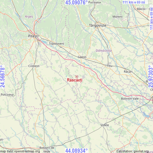
| Upper-left | 45.09076°, | 24.56678° |
| Center: | 44.59221°, | 25.2699° |
| Lower-right: | 44.08934°, | 25.97303° |
| Map W x H: | 111.3×111.3 km | = 69.2×69.2mi |
| max Lat: | 48.23793° ⇑83% North |
| Răscăeți: | 44.59221° |
| min Lat: | ⇓17% South 43.65638° |
| min Long | Răscăeți | max Long |
| 20.31667° | 25.2699° | 29.65403° |
| W 50.9%⇐ | ⇒49.1% E |
Elevation
Elevation of Răscăeți is 177 m = 581 ft, and this is 77.9 m = 256 ft below average elevation for this country.
| Max E: |
1278 m = 4193 ft | 57.3% |
| Avg. | 254.9 m = 836 ft | |
| Răscăeți | 177 m = 581 ft | |
Min E: |
-2 m = -7 ft | 42.7% |
See also: Romania elevation on elevation.city.
Geographical zone
Răscăeți is located in North temperate zone (between Tropic of Cancer and the Arctic Circle). Distance of this Northern Tropic circle is 2352.3 km =1461.7 mi to South.| Distance of | km | miles | from Răscăeți |
|---|---|---|---|
| North Pole | 5048.9 | 3137.2 | to North |
| Arctic Circle | 2443 | 1518 | to North |
| Tropic Cancer | 2352.3 | 1461.7 | to South |
| Equator | 4958.2 | 3080.9 | to South |


Nearby cities:
15 places around Răscăeți: (largest is in red/bold)
• Babaroaga
7.9 km =4.9 mi,  230°
230°
• Broșteni
6.4 km =4 mi,  76°
76°
• Fierbinți
9.5 km =5.9 mi,  171°
171°
• Gherghești
10.3 km =6.4 mi,  17°
17°
• Greci
9.6 km =6 mi,  37°
37°
• Izvoru
8.5 km =5.3 mi, 77°
• Jugureni
11.2 km =7 mi,  72°
72°
• Morteni
8.8 km =5.5 mi,  340°
340°
• Mozăceni
8.7 km =5.4 mi,  250°
250°
• Neajlovu
7.5 km =4.7 mi,  357°
357°
• Petreşti
8.2 km =5.1 mi, 37°
• Puntea de Greci
6.9 km =4.3 mi,  26°
26°
• Ragu
10.5 km =6.5 mi,  86°
86°
• Slobozia
7.8 km =4.8 mi,  196°
196°
• Vişina
5.1 km =3.2 mi,  101°
101°
Sources, notices
• [Note1] Compared only with cities in Romania existing in our database
• [Src1] Map data: © OpenStreetMap contributors (CC-BY-SA)
• [Src2] Other city data from geonames.org with taken over terms of usage.
• [Src3] Geographical zone / Annual Mean Temperature by Robert A. Rohde @ Wikipedia
