Pucheni geodata
Pucheni (Dâmboviţa) is a populated place; located in Romania in Europe/Bucharest (GMT+3) time zone. With population of 531 people, there are 6768 cities with bigger population in this country. Compared to other cities in Romania, 60.8% of cities are located further ↑North; 53.5% of cities are located further ←West and 94% of cities have lower elevation than Pucheni. Note1


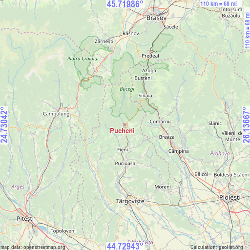
Pucheni GPS coordinates[2]
45° 13' 36.48" North, 25° 26' 0.744" East
| Map corner | latitude | longitude |
|---|---|---|
| Upper-left | 45.71986°, | 24.73042° |
| Center: | 45.2268°, | 25.43354° |
| Lower-right: | 44.72943°, | 26.13667° |
| Map W x H: | 110.1×110.1 km | = 68.4×68.4mi |
| max Lat: | 48.23793° ⇑60.8% North |
| Pucheni: | 45.2268° |
| min Lat: | ⇓39.2% South 43.65638° |
| min Long | Pucheni | max Long |
| 20.31667° | 25.43354° | 29.65403° |
| W 53.5%⇐ | ⇒46.5% E |
Elevation
Elevation of Pucheni is 595 m = 1952 ft, and this is 340.1 m = 1116 ft above average elevation for this country.
| Max E: |
1278 m = 4193 ft | 6% |
| Pucheni | 595 m 1952 ft | |
| Avg. | 254.9 m = 836 ft | |
Min E: |
-2 m = -7 ft | 94% |
See also: Romania elevation on elevation.city.
Geographical zone
Pucheni is located in North temperate zone (between Tropic of Cancer and the Arctic Circle). Distance of this North polar circle is 2372.4 km =1474.1 mi to North.| Distance of | km | miles | from Pucheni |
|---|---|---|---|
| North Pole | 4978.3 | 3093.4 | to North |
| Arctic Circle | 2372.4 | 1474.1 | to North |
| Tropic Cancer | 2422.8 | 1505.5 | to South |
| Equator | 5028.7 | 3124.7 | to South |


Nearby cities:
15 places around Pucheni: (largest is in red/bold)
• Brebu
8.2 km =5.1 mi,  240°
240°
• Buciumeni
8.6 km =5.3 mi,  171°
171°
• Bădeni
8.6 km =5.3 mi,  196°
196°
• Costești
9.7 km =6 mi, 200°
• Dealu Frumos
4.8 km =3 mi, 199°
• Dealu Mare
7.4 km =4.6 mi, 170°
• Ferestre
5.8 km =3.6 mi,  210°
210°
• Glod
2.1 km =1.3 mi,  37°
37°
• Lunca
3.1 km =1.9 mi, 165°
• Moroeni
1.1 km =0.7 mi,  180°
180°
• Piatra
7.3 km =4.5 mi, 203°
• Pietroşiţa
4.8 km =3 mi, 180°
• Runcu
6.2 km =3.9 mi,  219°
219°
• Siliștea
5.3 km =3.3 mi, 222°
• Valea Leurzii
8.3 km =5.2 mi,  150°
150°
Sources, notices
• [Note1] Compared only with cities in Romania existing in our database
• [Src1] Map data: © OpenStreetMap contributors (CC-BY-SA)
• [Src2] Other city data from geonames.org with taken over terms of usage.
• [Src3] Geographical zone / Annual Mean Temperature by Robert A. Rohde @ Wikipedia
