Pleșoi geodata
Pleșoi (Dolj) is a seat of a second-order administrative division; located in Romania in Europe/Bucharest (GMT+3) time zone. With population of 1,163 people, there are 3816 cities with bigger population in this country. Compared to other cities in Romania, 89.5% of cities are located further ↑North; 76.4% of cities are located further →East and 70% of cities have higher elevation than Pleșoi. Note1


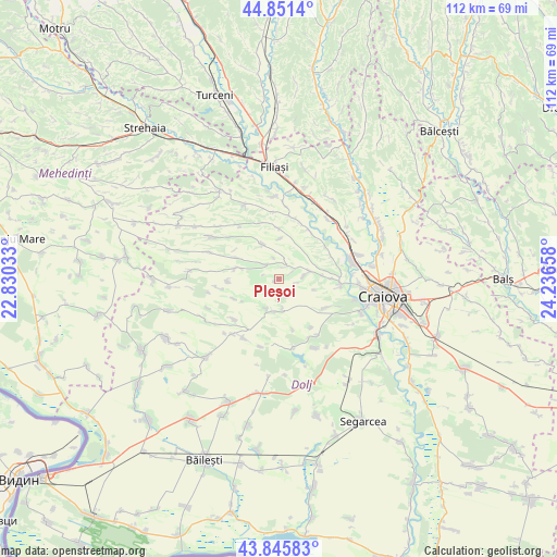
Pleșoi GPS coordinates[2]
44° 21' 2.772" North, 23° 32' 0.42" East
| Map corner | latitude | longitude |
|---|---|---|
| Upper-left | 44.8514°, | 22.83033° |
| Center: | 44.35077°, | 23.53345° |
| Lower-right: | 43.84583°, | 24.23658° |
| Map W x H: | 111.8×111.8 km | = 69.5×69.5mi |
| max Lat: | 48.23793° ⇑89.5% North |
| Pleșoi: | 44.35077° |
| min Lat: | ⇓10.5% South 43.65638° |
| min Long | Pleșoi | max Long |
| 20.31667° | 23.53345° | 29.65403° |
| W 23.6%⇐ | ⇒76.4% E |
Elevation
Elevation of Pleșoi is 127 m = 417 ft, and this is 127.9 m = 420 ft below average elevation for this country.
| Max E: |
1278 m = 4193 ft | 70% |
| Avg. | 254.9 m = 836 ft | |
| Pleșoi | 127 m = 417 ft | |
Min E: |
-2 m = -7 ft | 30% |
See also: Romania elevation on elevation.city.
Geographical zone
Pleșoi is located in North temperate zone (between Tropic of Cancer and the Arctic Circle). Distance of this Northern Tropic circle is 2325.4 km =1444.9 mi to South.| Distance of | km | miles | from Pleșoi |
|---|---|---|---|
| North Pole | 5075.7 | 3153.9 | to North |
| Arctic Circle | 2469.8 | 1534.7 | to North |
| Tropic Cancer | 2325.4 | 1444.9 | to South |
| Equator | 4931.3 | 3064.2 | to South |


Nearby cities:
15 places around Pleșoi: (largest is in red/bold)
• Brabova
8.2 km =5.1 mi,  282°
282°
• Breasta
12.1 km =7.5 mi,  99°
99°
• Coţofenii din Dos
11.3 km =7 mi,  35°
35°
• Căciulatu
9.8 km =6.1 mi,  245°
245°
• Mihăița
11.5 km =7.1 mi,  66°
66°
• Potmelțu
11.4 km =7.1 mi,  54°
54°
• Predeşti
5.3 km =3.3 mi,  90°
90°
• Rasnicu Oghian
10.3 km =6.4 mi,  358°
358°
• Răchita de Jos
10.2 km =6.3 mi,  267°
267°
• Sopot
7.8 km =4.8 mi,  340°
340°
• Sărbătoarea
11.1 km =6.9 mi,  121°
121°
• Terpeziţa
6.9 km =4.3 mi,  198°
198°
• Urdinița
9.5 km =5.9 mi,  296°
296°
• Valea Lungului
10.6 km =6.6 mi, 89°
• Vela
11.9 km =7.4 mi,  231°
231°
Sources, notices
• [Note1] Compared only with cities in Romania existing in our database
• [Src1] Map data: © OpenStreetMap contributors (CC-BY-SA)
• [Src2] Other city data from geonames.org with taken over terms of usage.
• [Src3] Geographical zone / Annual Mean Temperature by Robert A. Rohde @ Wikipedia
