Ocland geodata
Ocland (Harghita) is a seat of a second-order administrative division; located in Romania in Europe/Bucharest (GMT+3) time zone. With population of 1,383 people, there are 3372 cities with bigger population in this country. Compared to other cities in Romania, 58.8% of cities are located further ↓South; 53.1% of cities are located further ←West and 92.6% of cities have lower elevation than Ocland. Note1


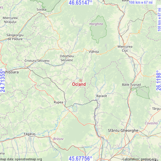
Ocland GPS coordinates[2]
46° 10' 0.012" North, 25° 25' 0.012" East
| Map corner | latitude | longitude |
|---|---|---|
| Upper-left | 46.65147°, | 24.71355° |
| Center: | 46.16667°, | 25.41667° |
| Lower-right: | 45.67756°, | 26.1198° |
| Map W x H: | 108.3×108.3 km | = 67.3×67.3mi |
| max Lat: | 48.23793° ⇑41.2% North |
| Ocland: | 46.16667° |
| min Lat: | ⇓58.8% South 43.65638° |
| min Long | Ocland | max Long |
| 20.31667° | 25.41667° | 29.65403° |
| W 53.1%⇐ | ⇒46.9% E |
Elevation
Elevation of Ocland is 562 m = 1844 ft, and this is 307.1 m = 1008 ft above average elevation for this country.
| Max E: |
1278 m = 4193 ft | 7.4% |
| Ocland | 562 m 1844 ft | |
| Avg. | 254.9 m = 836 ft | |
Min E: |
-2 m = -7 ft | 92.6% |
See also: Romania elevation on elevation.city.
Geographical zone
Ocland is located in North temperate zone (between Tropic of Cancer and the Arctic Circle). Distance of this North polar circle is 2267.9 km =1409.2 mi to North.| Distance of | km | miles | from Ocland |
|---|---|---|---|
| North Pole | 4873.8 | 3028.4 | to North |
| Arctic Circle | 2267.9 | 1409.2 | to North |
| Tropic Cancer | 2527.3 | 1570.4 | to South |
| Equator | 5133.3 | 3189.7 | to South |


Nearby cities:
15 places around Ocland: (largest is in red/bold)
• Brăduţ
15.8 km =9.8 mi,  103°
103°
• Caţa
14.8 km =9.2 mi,  231°
231°
• Crăciunel
2.1 km =1.3 mi,  35°
35°
• Doboșeni
14.4 km =8.9 mi,  109°
109°
• Drăușeni
8.8 km =5.5 mi,  250°
250°
• Filia
16 km =9.9 mi, 99°
• Jimbor
6.7 km =4.2 mi,  199°
199°
• Lueta
12.2 km =7.6 mi,  24°
24°
• Mercheașa
12.7 km =7.9 mi,  209°
209°
• Mereşti
7.8 km =4.8 mi, 19°
• Mărtiniş
7.8 km =4.8 mi,  340°
340°
• Racoș
15.7 km =9.8 mi,  181°
181°
• Racoșul de Sus
12.9 km =8 mi,  135°
135°
• Tălișoara
14.9 km =9.3 mi,  117°
117°
• Vârghiş
9.7 km =6 mi, 112°
Sources, notices
• [Note1] Compared only with cities in Romania existing in our database
• [Src1] Map data: © OpenStreetMap contributors (CC-BY-SA)
• [Src2] Other city data from geonames.org with taken over terms of usage.
• [Src3] Geographical zone / Annual Mean Temperature by Robert A. Rohde @ Wikipedia
