Vârghiş geodata
Vârghiş (Covasna) is a seat of a second-order administrative division; located in Romania in Europe/Bucharest (GMT+3) time zone. With population of 1,876 people, there are 2730 cities with bigger population in this country. Compared to other cities in Romania, 58% of cities are located further ↓South; 54.9% of cities are located further ←West and 90.5% of cities have lower elevation than Vârghiş. Note1


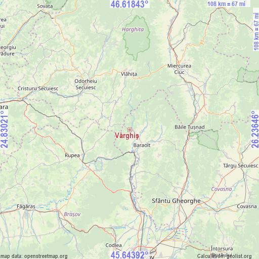
Vârghiş GPS coordinates[2]
46° 7' 59.988" North, 25° 31' 59.988" East
| Map corner | latitude | longitude |
|---|---|---|
| Upper-left | 46.61843°, | 24.83021° |
| Center: | 46.13333°, | 25.53333° |
| Lower-right: | 45.64392°, | 26.23646° |
| Map W x H: | 108.4×108.4 km | = 67.4×67.4mi |
| max Lat: | 48.23793° ⇑42% North |
| Vârghiş: | 46.13333° |
| min Lat: | ⇓58% South 43.65638° |
| min Long | Vârghiş | max Long |
| 20.31667° | 25.53333° | 29.65403° |
| W 54.9%⇐ | ⇒45.1% E |
Elevation
Elevation of Vârghiş is 521 m = 1709 ft, and this is 266.1 m = 873 ft above average elevation for this country.
| Max E: |
1278 m = 4193 ft | 9.5% |
| Vârghiş | 521 m 1709 ft | |
| Avg. | 254.9 m = 836 ft | |
Min E: |
-2 m = -7 ft | 90.5% |
See also: Romania elevation on elevation.city.
Geographical zone
Vârghiş is located in North temperate zone (between Tropic of Cancer and the Arctic Circle). Distance of this North polar circle is 2271.6 km =1411.5 mi to North.| Distance of | km | miles | from Vârghiş |
|---|---|---|---|
| North Pole | 4877.5 | 3030.7 | to North |
| Arctic Circle | 2271.6 | 1411.5 | to North |
| Tropic Cancer | 2523.6 | 1568.1 | to South |
| Equator | 5129.5 | 3187.3 | to South |


Nearby cities:
15 places around Vârghiş: (largest is in red/bold)
• Augustin
9.8 km =6.1 mi,  170°
170°
• Baraolt
8.3 km =5.2 mi,  141°
141°
• Biborțeni
10.3 km =6.4 mi,  114°
114°
• Brăduţ
6.4 km =4 mi,  90°
90°
• Băţanii Mari
12.8 km =8 mi,  115°
115°
• Bățanii Mici
12.9 km =8 mi,  104°
104°
• Crăciunel
9.5 km =5.9 mi,  305°
305°
• Căpeni
10.8 km =6.7 mi,  161°
161°
• Doboșeni
4.7 km =2.9 mi, 102°
• Filia
6.9 km =4.3 mi,  80°
80°
• Jimbor
11.5 km =7.1 mi,  256°
256°
• Mereşti
12.8 km =8 mi,  330°
330°
• Ocland
9.7 km =6 mi,  292°
292°
• Racoșul de Sus
5.6 km =3.5 mi,  180°
180°
• Tălișoara
5.3 km =3.3 mi,  126°
126°
Sources, notices
• [Note1] Compared only with cities in Romania existing in our database
• [Src1] Map data: © OpenStreetMap contributors (CC-BY-SA)
• [Src2] Other city data from geonames.org with taken over terms of usage.
• [Src3] Geographical zone / Annual Mean Temperature by Robert A. Rohde @ Wikipedia
