Jimbor geodata
Jimbor (Braşov) is a populated place; located in Romania in Europe/Bucharest (GMT+3) time zone. With population of 549 people, there are 6588 cities with bigger population in this country. Compared to other cities in Romania, 57.6% of cities are located further ↓South; 52.6% of cities are located further ←West and 88.1% of cities have lower elevation than Jimbor. Note1


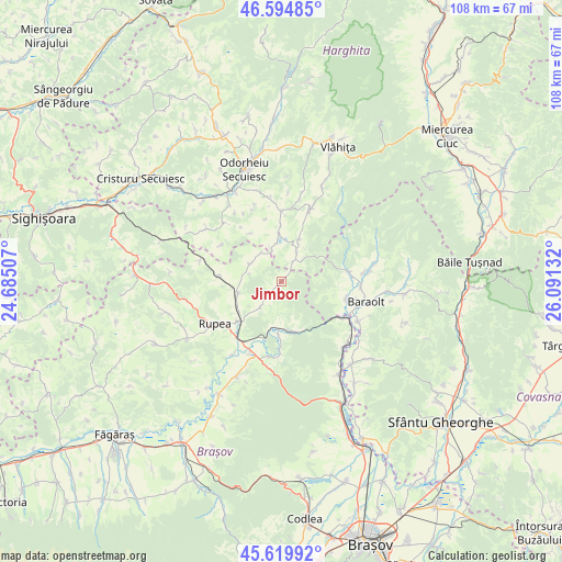
Jimbor GPS coordinates[2]
46° 6' 34.344" North, 25° 23' 17.484" East
| Map corner | latitude | longitude |
|---|---|---|
| Upper-left | 46.59485°, | 24.68507° |
| Center: | 46.10954°, | 25.38819° |
| Lower-right: | 45.61992°, | 26.09132° |
| Map W x H: | 108.4×108.4 km | = 67.4×67.4mi |
| max Lat: | 48.23793° ⇑42.4% North |
| Jimbor: | 46.10954° |
| min Lat: | ⇓57.6% South 43.65638° |
| min Long | Jimbor | max Long |
| 20.31667° | 25.38819° | 29.65403° |
| W 52.6%⇐ | ⇒47.4% E |
Elevation
Elevation of Jimbor is 486 m = 1594 ft, and this is 231.1 m = 758 ft above average elevation for this country.
| Max E: |
1278 m = 4193 ft | 11.9% |
| Jimbor | 486 m 1594 ft | |
| Avg. | 254.9 m = 836 ft | |
Min E: |
-2 m = -7 ft | 88.1% |
See also: Romania elevation on elevation.city.
Geographical zone
Jimbor is located in North temperate zone (between Tropic of Cancer and the Arctic Circle). Distance of this North polar circle is 2274.3 km =1413.2 mi to North.| Distance of | km | miles | from Jimbor |
|---|---|---|---|
| North Pole | 4880.2 | 3032.4 | to North |
| Arctic Circle | 2274.3 | 1413.2 | to North |
| Tropic Cancer | 2521 | 1566.5 | to South |
| Equator | 5126.9 | 3185.7 | to South |


Nearby cities:
15 places around Jimbor: (largest is in red/bold)
• Augustin
14.6 km =9.1 mi,  118°
118°
• Caţa
9.8 km =6.1 mi,  252°
252°
• Crăciunel
8.8 km =5.5 mi,  23°
23°
• Dopca
14 km =8.7 mi,  180°
180°
• Drăușeni
7 km =4.3 mi,  299°
299°
• Hoghiz
15.6 km =9.7 mi,  205°
205°
• Homorod
11.5 km =7.1 mi,  234°
234°
• Mercheașa
6.2 km =3.9 mi,  220°
220°
• Mereşti
14.6 km =9.1 mi, 19°
• Mărtiniş
13.8 km =8.6 mi,  358°
358°
• Ocland
6.7 km =4.2 mi, 19°
• Racoș
9.5 km =5.9 mi,  169°
169°
• Racoșul de Sus
11.6 km =7.2 mi,  104°
104°
• Tălișoara
15.5 km =9.6 mi,  91°
91°
• Vârghiş
11.5 km =7.1 mi,  76°
76°
Sources, notices
• [Note1] Compared only with cities in Romania existing in our database
• [Src1] Map data: © OpenStreetMap contributors (CC-BY-SA)
• [Src2] Other city data from geonames.org with taken over terms of usage.
• [Src3] Geographical zone / Annual Mean Temperature by Robert A. Rohde @ Wikipedia
