Crăciunel geodata
Crăciunel (Harghita) is a populated place; located in Romania in Europe/Bucharest (GMT+3) time zone. With population of 527 people, there are 6800 cities with bigger population in this country. Compared to other cities in Romania, 59.1% of cities are located further ↓South; 53.4% of cities are located further ←West and 91.1% of cities have lower elevation than Crăciunel. Note1


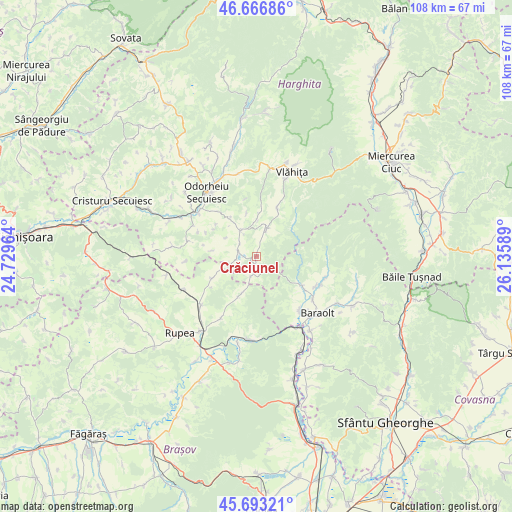
Crăciunel GPS coordinates[2]
46° 10' 55.884" North, 25° 25' 57.936" East
| Map corner | latitude | longitude |
|---|---|---|
| Upper-left | 46.66686°, | 24.72964° |
| Center: | 46.18219°, | 25.43276° |
| Lower-right: | 45.69321°, | 26.13589° |
| Map W x H: | 108.3×108.3 km | = 67.3×67.3mi |
| max Lat: | 48.23793° ⇑40.9% North |
| Crăciunel: | 46.18219° |
| min Lat: | ⇓59.1% South 43.65638° |
| min Long | Crăciunel | max Long |
| 20.31667° | 25.43276° | 29.65403° |
| W 53.4%⇐ | ⇒46.6% E |
Elevation
Elevation of Crăciunel is 531 m = 1742 ft, and this is 276.1 m = 906 ft above average elevation for this country.
| Max E: |
1278 m = 4193 ft | 8.9% |
| Crăciunel | 531 m 1742 ft | |
| Avg. | 254.9 m = 836 ft | |
Min E: |
-2 m = -7 ft | 91.1% |
See also: Romania elevation on elevation.city.
Geographical zone
Crăciunel is located in North temperate zone (between Tropic of Cancer and the Arctic Circle). Distance of this North polar circle is 2266.2 km =1408.2 mi to North.| Distance of | km | miles | from Crăciunel |
|---|---|---|---|
| North Pole | 4872.1 | 3027.4 | to North |
| Arctic Circle | 2266.2 | 1408.2 | to North |
| Tropic Cancer | 2529.1 | 1571.5 | to South |
| Equator | 5135 | 3190.7 | to South |


Nearby cities:
15 places around Crăciunel: (largest is in red/bold)
• Brăduţ
15.2 km =9.4 mi,  110°
110°
• Doboșeni
14 km =8.7 mi,  117°
117°
• Drăușeni
10.6 km =6.6 mi,  243°
243°
• Feliceni
15.9 km =9.9 mi,  306°
306°
• Filia
15.1 km =9.4 mi, 106°
• Jimbor
8.8 km =5.5 mi,  203°
203°
• Lueta
10.2 km =6.3 mi,  22°
22°
• Mercheașa
14.9 km =9.3 mi,  210°
210°
• Mereşti
5.8 km =3.6 mi,  13°
13°
• Mărtiniş
6.8 km =4.2 mi,  326°
326°
• Ocland
2.1 km =1.3 mi,  215°
215°
• Odorheiu Secuiesc
16.6 km =10.3 mi,  322°
322°
• Racoșul de Sus
13.4 km =8.3 mi,  144°
144°
• Tălișoara
14.8 km =9.2 mi,  125°
125°
• Vârghiş
9.5 km =5.9 mi, 125°
Sources, notices
• [Note1] Compared only with cities in Romania existing in our database
• [Src1] Map data: © OpenStreetMap contributors (CC-BY-SA)
• [Src2] Other city data from geonames.org with taken over terms of usage.
• [Src3] Geographical zone / Annual Mean Temperature by Robert A. Rohde @ Wikipedia
