Nireș geodata
Nireș (Cluj) is a populated place; located in Romania in Europe/Bucharest (GMT+3) time zone. With population of 1,233 people, there are 3670 cities with bigger population in this country. Compared to other cities in Romania, 81.7% of cities are located further ↓South; 69.8% of cities are located further →East and 58.8% of cities have lower elevation than Nireș. Note1


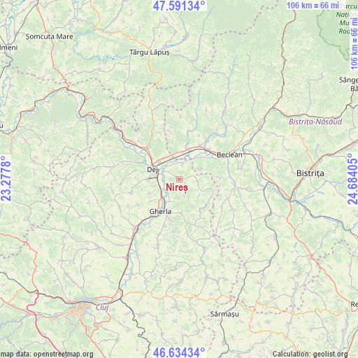
Nireș GPS coordinates[2]
47° 6' 53.964" North, 23° 58' 51.312" East
| Map corner | latitude | longitude |
|---|---|---|
| Upper-left | 47.59134°, | 23.2778° |
| Center: | 47.11499°, | 23.98092° |
| Lower-right: | 46.63434°, | 24.68405° |
| Map W x H: | 106.4×106.4 km | = 66.1×66.1mi |
| max Lat: | 48.23793° ⇑18.3% North |
| Nireș: | 47.11499° |
| min Lat: | ⇓81.7% South 43.65638° |
| min Long | Nireș | max Long |
| 20.31667° | 23.98092° | 29.65403° |
| W 30.2%⇐ | ⇒69.8% E |
Elevation
Elevation of Nireș is 256 m = 840 ft, and this is 1.1 m = 4 ft above average elevation for this country.
| Max E: |
1278 m = 4193 ft | 41.2% |
| Nireș | 256 m 840 ft | |
| Avg. | 254.9 m = 836 ft | |
Min E: |
-2 m = -7 ft | 58.8% |
See also: Romania elevation on elevation.city.
Geographical zone
Nireș is located in North temperate zone (between Tropic of Cancer and the Arctic Circle). Distance of this North polar circle is 2162.5 km =1343.7 mi to North.| Distance of | km | miles | from Nireș |
|---|---|---|---|
| North Pole | 4768.4 | 2962.9 | to North |
| Arctic Circle | 2162.5 | 1343.7 | to North |
| Tropic Cancer | 2632.8 | 1635.9 | to South |
| Equator | 5238.7 | 3255.2 | to South |


Nearby cities:
15 places around Nireș: (largest is in red/bold)
• Batin
7.7 km =4.8 mi,  127°
127°
• Bața
8.3 km =5.2 mi,  7°
7°
• Braniştea
8.7 km =5.4 mi,  48°
48°
• Ciceu-Mihăiești
7.9 km =4.9 mi,  356°
356°
• Cireșoaia
6.9 km =4.3 mi,  63°
63°
• Cuzdrioara
7.5 km =4.7 mi,  319°
319°
• Mica
4.1 km =2.5 mi,  299°
299°
• Mintiu Gherlii
7.6 km =4.7 mi,  197°
197°
• Mănăstirea
3.6 km =2.2 mi,  272°
272°
• Mănășturel
6.6 km =4.1 mi,  341°
341°
• Nima
9.5 km =5.9 mi,  243°
243°
• Ocna Dejului
9.2 km =5.7 mi, 270°
• Reteag
9.4 km =5.8 mi,  17°
17°
• Sânmărghita
4.7 km =2.9 mi, 12°
• Unguraş
5.2 km =3.2 mi,  87°
87°
Sources, notices
• [Note1] Compared only with cities in Romania existing in our database
• [Src1] Map data: © OpenStreetMap contributors (CC-BY-SA)
• [Src2] Other city data from geonames.org with taken over terms of usage.
• [Src3] Geographical zone / Annual Mean Temperature by Robert A. Rohde @ Wikipedia
