Negrilești geodata
Negrilești (Galaţi) is a seat of a second-order administrative division; located in Romania in Europe/Bucharest (GMT+3) time zone. With population of 1,530 people, there are 3129 cities with bigger population in this country. Compared to other cities in Romania, 54.1% of cities are located further ↓South; 90.7% of cities are located further ←West and 92.4% of cities have higher elevation than Negrilești. Note1


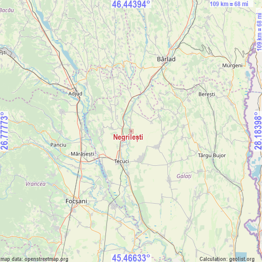
Negrilești GPS coordinates[2]
45° 57' 26.244" North, 27° 28' 51.06" East
| Map corner | latitude | longitude |
|---|---|---|
| Upper-left | 46.44394°, | 26.77773° |
| Center: | 45.95729°, | 27.48085° |
| Lower-right: | 45.46633°, | 28.18398° |
| Map W x H: | 108.7×108.7 km | = 67.5×67.5mi |
| max Lat: | 48.23793° ⇑45.9% North |
| Negrilești: | 45.95729° |
| min Lat: | ⇓54.1% South 43.65638° |
| min Long | Negrilești | max Long |
| 20.31667° | 27.48085° | 29.65403° |
| W 90.7%⇐ | ⇒9.3% E |
Elevation
Elevation of Negrilești is 47 m = 154 ft, and this is 207.9 m = 682 ft below average elevation for this country.
| Max E: |
1278 m = 4193 ft | 92.4% |
| Avg. | 254.9 m = 836 ft | |
| Negrilești | 47 m = 154 ft | |
Min E: |
-2 m = -7 ft | 7.6% |
See also: Romania elevation on elevation.city.
Geographical zone
Negrilești is located in North temperate zone (between Tropic of Cancer and the Arctic Circle). Distance of this North polar circle is 2291.2 km =1423.7 mi to North.| Distance of | km | miles | from Negrilești |
|---|---|---|---|
| North Pole | 4897.1 | 3042.9 | to North |
| Arctic Circle | 2291.2 | 1423.7 | to North |
| Tropic Cancer | 2504.1 | 1556 | to South |
| Equator | 5110 | 3175.2 | to South |


Nearby cities:
15 places around Negrilești: (largest is in red/bold)
• Brăhășești
12.2 km =7.6 mi,  313°
313°
• Cerţeşti
12.4 km =7.7 mi,  57°
57°
• Corod
12.3 km =7.6 mi,  121°
121°
• Cârlomănești
8.4 km =5.2 mi,  69°
69°
• Gara Berheci
3.8 km =2.4 mi,  299°
299°
• Ghidigeni
10.4 km =6.5 mi,  8°
8°
• Munteni
4.5 km =2.8 mi,  234°
234°
• Nărtești
8.3 km =5.2 mi,  317°
317°
• Slobozia Blăneasa
2.1 km =1.3 mi,  182°
182°
• Slobozia Corni
3.8 km =2.4 mi,  359°
359°
• Tecucelu Sec
12 km =7.5 mi,  282°
282°
• Tălpigi
5.7 km =3.5 mi,  353°
353°
• Ungureni
5 km =3.1 mi,  189°
189°
• Ţepu
8.9 km =5.5 mi, 276°
• Țigănești
7.1 km =4.4 mi,  209°
209°
Sources, notices
• [Note1] Compared only with cities in Romania existing in our database
• [Src1] Map data: © OpenStreetMap contributors (CC-BY-SA)
• [Src2] Other city data from geonames.org with taken over terms of usage.
• [Src3] Geographical zone / Annual Mean Temperature by Robert A. Rohde @ Wikipedia
