Murgești geodata
Murgești (Gorj) is a populated place; located in Romania in Europe/Bucharest (GMT+3) time zone. With population of 800 people, there are 5046 cities with bigger population in this country. Compared to other cities in Romania, 79.8% of cities are located further ↑North; 79% of cities are located further →East and 68% of cities have higher elevation than Murgești. Note1


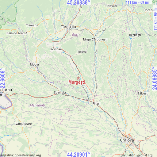
Murgești GPS coordinates[2]
44° 42' 39.06" North, 23° 21' 49.392" East
| Map corner | latitude | longitude |
|---|---|---|
| Upper-left | 45.20838°, | 22.6606° |
| Center: | 44.71085°, | 23.36372° |
| Lower-right: | 44.20901°, | 24.06685° |
| Map W x H: | 111.1×111.1 km | = 69×69mi |
| max Lat: | 48.23793° ⇑79.8% North |
| Murgești: | 44.71085° |
| min Lat: | ⇓20.2% South 43.65638° |
| min Long | Murgești | max Long |
| 20.31667° | 23.36372° | 29.65403° |
| W 21%⇐ | ⇒79% E |
Elevation
Elevation of Murgești is 135 m = 443 ft, and this is 119.9 m = 393 ft below average elevation for this country.
| Max E: |
1278 m = 4193 ft | 68% |
| Avg. | 254.9 m = 836 ft | |
| Murgești | 135 m = 443 ft | |
Min E: |
-2 m = -7 ft | 32% |
See also: Romania elevation on elevation.city.
Geographical zone
Murgești is located in North temperate zone (between Tropic of Cancer and the Arctic Circle). Distance of this Northern Tropic circle is 2365.5 km =1469.9 mi to South.| Distance of | km | miles | from Murgești |
|---|---|---|---|
| North Pole | 5035.7 | 3129 | to North |
| Arctic Circle | 2429.8 | 1509.8 | to North |
| Tropic Cancer | 2365.5 | 1469.9 | to South |
| Equator | 4971.4 | 3089.1 | to South |


Nearby cities:
15 places around Murgești: (largest is in red/bold)
• Borăscu
6.5 km =4 mi,  259°
259°
• Calapăru
3.9 km =2.4 mi,  218°
218°
• Costești
6.9 km =4.3 mi,  69°
69°
• Fântânele
8.6 km =5.3 mi,  330°
330°
• Grozeşti
7.7 km =4.8 mi,  208°
208°
• Groșerea
9.4 km =5.8 mi,  83°
83°
• Iliești
8.1 km =5 mi,  158°
158°
• Izvoarele
2.9 km =1.8 mi, 75°
• Ohaba Jiu
9.3 km =5.8 mi,  276°
276°
• Piscuri
7.7 km =4.8 mi,  17°
17°
• Plopşoru
8.1 km =5 mi,  352°
352°
• Sărdănești
6.7 km =4.2 mi,  358°
358°
• Turceni
3.1 km =1.9 mi,  175°
175°
• Valea Viei
4.1 km =2.5 mi, 325°
• Văleni
3.8 km =2.4 mi,  28°
28°
Sources, notices
• [Note1] Compared only with cities in Romania existing in our database
• [Src1] Map data: © OpenStreetMap contributors (CC-BY-SA)
• [Src2] Other city data from geonames.org with taken over terms of usage.
• [Src3] Geographical zone / Annual Mean Temperature by Robert A. Rohde @ Wikipedia
