Movileni geodata
Movileni (Olt) is a seat of a second-order administrative division; located in Romania in Europe/Bucharest (GMT+3) time zone. With population of 3,839 people, there are 1236 cities with bigger population in this country. Compared to other cities in Romania, 89.2% of cities are located further ↑North; 58.2% of cities are located further →East and 61.7% of cities have higher elevation than Movileni. Note1


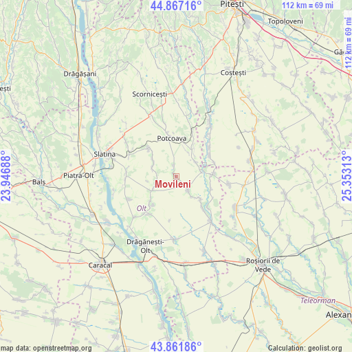
Movileni GPS coordinates[2]
44° 22' 0.012" North, 24° 39' 0" East
| Map corner | latitude | longitude |
|---|---|---|
| Upper-left | 44.86716°, | 23.94688° |
| Center: | 44.36667°, | 24.65° |
| Lower-right: | 43.86186°, | 25.35313° |
| Map W x H: | 111.8×111.8 km | = 69.5×69.5mi |
| max Lat: | 48.23793° ⇑89.2% North |
| Movileni: | 44.36667° |
| min Lat: | ⇓10.8% South 43.65638° |
| min Long | Movileni | max Long |
| 20.31667° | 24.65° | 29.65403° |
| W 41.8%⇐ | ⇒58.2% E |
Elevation
Elevation of Movileni is 160 m = 525 ft, and this is 94.9 m = 311 ft below average elevation for this country.
| Max E: |
1278 m = 4193 ft | 61.7% |
| Avg. | 254.9 m = 836 ft | |
| Movileni | 160 m = 525 ft | |
Min E: |
-2 m = -7 ft | 38.3% |
See also: Romania elevation on elevation.city.
Geographical zone
Movileni is located in North temperate zone (between Tropic of Cancer and the Arctic Circle). Distance of this Northern Tropic circle is 2327.2 km =1446.1 mi to South.| Distance of | km | miles | from Movileni |
|---|---|---|---|
| North Pole | 5074 | 3152.8 | to North |
| Arctic Circle | 2468.1 | 1533.6 | to North |
| Tropic Cancer | 2327.2 | 1446.1 | to South |
| Equator | 4933.1 | 3065.3 | to South |


Nearby cities:
15 places around Movileni: (largest is in red/bold)
• Bacea
3.6 km =2.2 mi,  344°
344°
• Buta
8.1 km =5 mi,  143°
143°
• Catanele
7.2 km =4.5 mi,  283°
283°
• Floru
8.5 km =5.3 mi,  82°
82°
• Ghioca
8.6 km =5.3 mi,  129°
129°
• Greci
8.3 km =5.2 mi,  240°
240°
• Icoana
7.7 km =4.8 mi,  43°
43°
• Mierleștii de Sus
8.5 km =5.3 mi,  301°
301°
• Milcoveni
8.8 km =5.5 mi, 41°
• Măgura
8.1 km =5 mi,  291°
291°
• Perieţi
8.8 km =5.5 mi, 295°
• Schitu
6.9 km =4.3 mi,  254°
254°
• Ursoaia
8.4 km =5.2 mi,  25°
25°
• Şerbăneşti
5.4 km =3.4 mi, 132°
• Șerbăneștii de Sus
4.3 km =2.7 mi, 141°
Sources, notices
• [Note1] Compared only with cities in Romania existing in our database
• [Src1] Map data: © OpenStreetMap contributors (CC-BY-SA)
• [Src2] Other city data from geonames.org with taken over terms of usage.
• [Src3] Geographical zone / Annual Mean Temperature by Robert A. Rohde @ Wikipedia
