Perieţi geodata
Perieţi (Olt) is a seat of a second-order administrative division; located in Romania in Europe/Bucharest (GMT+3) time zone. With population of 3,963 people, there are 1177 cities with bigger population in this country. Compared to other cities in Romania, 88.1% of cities are located further ↑North; 59.6% of cities are located further →East and 56.3% of cities have higher elevation than Perieţi. Note1


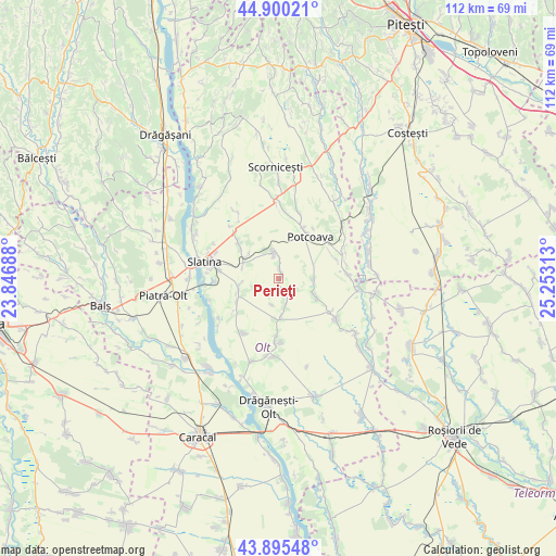
Perieţi GPS coordinates[2]
44° 24' 0" North, 24° 33' 0" East
| Map corner | latitude | longitude |
|---|---|---|
| Upper-left | 44.90021°, | 23.84688° |
| Center: | 44.4°, | 24.55° |
| Lower-right: | 43.89548°, | 25.25313° |
| Map W x H: | 111.7×111.7 km | = 69.4×69.4mi |
| max Lat: | 48.23793° ⇑88.1% North |
| Perieţi: | 44.4° |
| min Lat: | ⇓11.9% South 43.65638° |
| min Long | Perieţi | max Long |
| 20.31667° | 24.55° | 29.65403° |
| W 40.4%⇐ | ⇒59.6% E |
Elevation
Elevation of Perieţi is 181 m = 594 ft, and this is 73.9 m = 242 ft below average elevation for this country.
| Max E: |
1278 m = 4193 ft | 56.3% |
| Avg. | 254.9 m = 836 ft | |
| Perieţi | 181 m = 594 ft | |
Min E: |
-2 m = -7 ft | 43.7% |
See also: Romania elevation on elevation.city.
Geographical zone
Perieţi is located in North temperate zone (between Tropic of Cancer and the Arctic Circle). Distance of this Northern Tropic circle is 2330.9 km =1448.4 mi to South.| Distance of | km | miles | from Perieţi |
|---|---|---|---|
| North Pole | 5070.2 | 3150.5 | to North |
| Arctic Circle | 2464.4 | 1531.3 | to North |
| Tropic Cancer | 2330.9 | 1448.4 | to South |
| Equator | 4936.8 | 3067.6 | to South |


Nearby cities:
15 places around Perieţi: (largest is in red/bold)
• Bacea
7 km =4.3 mi,  91°
91°
• Brebeni
8.8 km =5.5 mi,  244°
244°
• Bârca
9.3 km =5.8 mi,  306°
306°
• Bălteni
5.6 km =3.5 mi,  345°
345°
• Bărcănești
11.1 km =6.9 mi,  181°
181°
• Catanele
2.2 km =1.4 mi,  155°
155°
• Greci
7.8 km =4.8 mi,  174°
174°
• Lisa
5.5 km =3.4 mi,  194°
194°
• Mierleștii de Sus
1 km =0.6 mi,  45°
45°
• Movileni
8.8 km =5.5 mi,  115°
115°
• Măgura
0.8 km =0.5 mi,  150°
150°
• Potcoava Fălcoeni
11.8 km =7.3 mi,  26°
26°
• Schitu
5.7 km =3.5 mi, 166°
• Turia
7.7 km =4.8 mi, 312°
• Valea Merilor
11.6 km =7.2 mi, 46°
Sources, notices
• [Note1] Compared only with cities in Romania existing in our database
• [Src1] Map data: © OpenStreetMap contributors (CC-BY-SA)
• [Src2] Other city data from geonames.org with taken over terms of usage.
• [Src3] Geographical zone / Annual Mean Temperature by Robert A. Rohde @ Wikipedia
