Malnaş geodata
Malnaş (Covasna) is a seat of a second-order administrative division; located in Romania in Europe/Bucharest (GMT+3) time zone. With population of 4,804 people, there are 840 cities with bigger population in this country. Compared to other cities in Romania, 55.4% of cities are located further ↓South; 59.8% of cities are located further ←West and 92.9% of cities have lower elevation than Malnaş. Note1


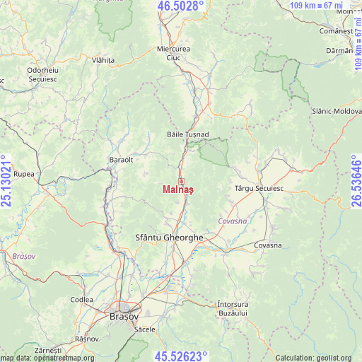
Malnaş GPS coordinates[2]
46° 1' 0.012" North, 25° 49' 59.988" East
| Map corner | latitude | longitude |
|---|---|---|
| Upper-left | 46.5028°, | 25.13021° |
| Center: | 46.01667°, | 25.83333° |
| Lower-right: | 45.52623°, | 26.53646° |
| Map W x H: | 108.6×108.6 km | = 67.5×67.5mi |
| max Lat: | 48.23793° ⇑44.6% North |
| Malnaş: | 46.01667° |
| min Lat: | ⇓55.4% South 43.65638° |
| min Long | Malnaş | max Long |
| 20.31667° | 25.83333° | 29.65403° |
| W 59.8%⇐ | ⇒40.2% E |
Elevation
Elevation of Malnaş is 568 m = 1864 ft, and this is 313.1 m = 1027 ft above average elevation for this country.
| Max E: |
1278 m = 4193 ft | 7.1% |
| Malnaş | 568 m 1864 ft | |
| Avg. | 254.9 m = 836 ft | |
Min E: |
-2 m = -7 ft | 92.9% |
See also: Romania elevation on elevation.city.
Geographical zone
Malnaş is located in North temperate zone (between Tropic of Cancer and the Arctic Circle). Distance of this North polar circle is 2284.6 km =1419.6 mi to North.| Distance of | km | miles | from Malnaş |
|---|---|---|---|
| North Pole | 4890.5 | 3038.8 | to North |
| Arctic Circle | 2284.6 | 1419.6 | to North |
| Tropic Cancer | 2510.7 | 1560.1 | to South |
| Equator | 5116.6 | 3179.3 | to South |


Nearby cities:
15 places around Malnaş: (largest is in red/bold)
• Aita Seacă
11 km =6.8 mi,  283°
283°
• Angheluș
15.9 km =9.9 mi,  164°
164°
• Arcuș
13.6 km =8.5 mi,  198°
198°
• Bixad
9.6 km =6 mi,  15°
15°
• Bodoc
7.5 km =4.7 mi,  170°
170°
• Băile Tuşnad
14.9 km =9.3 mi,  4°
4°
• Băţanii Mari
13.7 km =8.5 mi,  302°
302°
• Bățanii Mici
14.4 km =8.9 mi,  312°
312°
• Calnic
10 km =6.2 mi, 202°
• Dalnic
15.9 km =9.9 mi,  131°
131°
• Ghidfalău
13 km =8.1 mi, 174°
• Micfalău
4.1 km =2.5 mi, 4°
• Olteni
5.4 km =3.4 mi, 166°
• Valea Crişului
12.3 km =7.6 mi, 204°
• Zălan
6.4 km =4 mi,  191°
191°
Sources, notices
• [Note1] Compared only with cities in Romania existing in our database
• [Src1] Map data: © OpenStreetMap contributors (CC-BY-SA)
• [Src2] Other city data from geonames.org with taken over terms of usage.
• [Src3] Geographical zone / Annual Mean Temperature by Robert A. Rohde @ Wikipedia
