Liiceni geodata
Liiceni (Olt) is a populated place; located in Romania in Europe/Bucharest (GMT+3) time zone. With population of 551 people, there are 6574 cities with bigger population in this country. Compared to other cities in Romania, 94.9% of cities are located further ↑North; 64.4% of cities are located further →East and 70.6% of cities have higher elevation than Liiceni. Note1


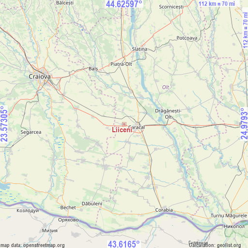
Liiceni GPS coordinates[2]
44° 7' 24.204" North, 24° 16' 34.212" East
| Map corner | latitude | longitude |
|---|---|---|
| Upper-left | 44.62597°, | 23.57305° |
| Center: | 44.12339°, | 24.27617° |
| Lower-right: | 43.6165°, | 24.9793° |
| Map W x H: | 112.2×112.2 km | = 69.7×69.7mi |
| max Lat: | 48.23793° ⇑94.9% North |
| Liiceni: | 44.12339° |
| min Lat: | ⇓5.1% South 43.65638° |
| min Long | Liiceni | max Long |
| 20.31667° | 24.27617° | 29.65403° |
| W 35.6%⇐ | ⇒64.4% E |
Elevation
Elevation of Liiceni is 125 m = 410 ft, and this is 129.9 m = 426 ft below average elevation for this country.
| Max E: |
1278 m = 4193 ft | 70.6% |
| Avg. | 254.9 m = 836 ft | |
| Liiceni | 125 m = 410 ft | |
Min E: |
-2 m = -7 ft | 29.4% |
See also: Romania elevation on elevation.city.
Geographical zone
Liiceni is located in North temperate zone (between Tropic of Cancer and the Arctic Circle). Distance of this Northern Tropic circle is 2300.1 km =1429.2 mi to South.| Distance of | km | miles | from Liiceni |
|---|---|---|---|
| North Pole | 5101 | 3169.6 | to North |
| Arctic Circle | 2495.1 | 1550.4 | to North |
| Tropic Cancer | 2300.1 | 1429.2 | to South |
| Equator | 4906.1 | 3048.5 | to South |


Nearby cities:
15 places around Liiceni: (largest is in red/bold)
• Caracal
5.9 km =3.7 mi,  97°
97°
• Cezieni
6.7 km =4.2 mi,  353°
353°
• Ciocănești
9.9 km =6.2 mi,  294°
294°
• Comanca
8.3 km =5.2 mi,  127°
127°
• Deveselu
10.6 km =6.6 mi, 126°
• Dioşti
7.4 km =4.6 mi,  264°
264°
• Dobrosloveni
9.8 km =6.1 mi,  47°
47°
• Drăghiceni
2.4 km =1.5 mi,  297°
297°
• Grozăvești
3.3 km =2.1 mi, 285°
• Hotărani
11.6 km =7.2 mi,  66°
66°
• Potopinu
10 km =6.2 mi,  38°
38°
• Radomir
8.6 km =5.3 mi,  268°
268°
• Redea
8.4 km =5.2 mi,  166°
166°
• Redișoara
10.6 km =6.6 mi,  147°
147°
• Reșca
10.8 km =6.7 mi,  59°
59°
Sources, notices
• [Note1] Compared only with cities in Romania existing in our database
• [Src1] Map data: © OpenStreetMap contributors (CC-BY-SA)
• [Src2] Other city data from geonames.org with taken over terms of usage.
• [Src3] Geographical zone / Annual Mean Temperature by Robert A. Rohde @ Wikipedia
