Lămotești geodata
Lămotești (Vrancea) is a populated place; located in Romania in Europe/Bucharest (GMT+3) time zone. With population of 889 people, there are 4662 cities with bigger population in this country. Compared to other cities in Romania, 52.7% of cities are located further ↑North; 87.6% of cities are located further ←West and 94.4% of cities have higher elevation than Lămotești. Note1


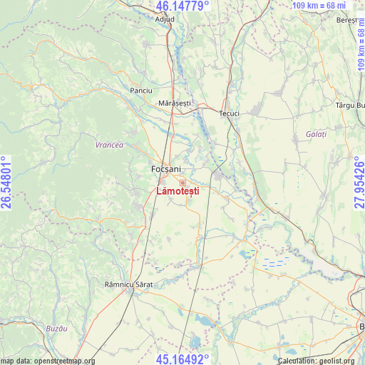
Lămotești GPS coordinates[2]
45° 39' 30.636" North, 27° 15' 4.068" East
| Map corner | latitude | longitude |
|---|---|---|
| Upper-left | 46.14779°, | 26.54801° |
| Center: | 45.65851°, | 27.25113° |
| Lower-right: | 45.16492°, | 27.95426° |
| Map W x H: | 109.3×109.3 km | = 67.9×67.9mi |
| max Lat: | 48.23793° ⇑52.7% North |
| Lămotești: | 45.65851° |
| min Lat: | ⇓47.3% South 43.65638° |
| min Long | Lămotești | max Long |
| 20.31667° | 27.25113° | 29.65403° |
| W 87.6%⇐ | ⇒12.4% E |
Elevation
Elevation of Lămotești is 37 m = 121 ft, and this is 217.9 m = 715 ft below average elevation for this country.
| Max E: |
1278 m = 4193 ft | 94.4% |
| Avg. | 254.9 m = 836 ft | |
| Lămotești | 37 m = 121 ft | |
Min E: |
-2 m = -7 ft | 5.6% |
See also: Romania elevation on elevation.city.
Geographical zone
Lămotești is located in North temperate zone (between Tropic of Cancer and the Arctic Circle). Distance of this North polar circle is 2324.4 km =1444.3 mi to North.| Distance of | km | miles | from Lămotești |
|---|---|---|---|
| North Pole | 4930.3 | 3063.5 | to North |
| Arctic Circle | 2324.4 | 1444.3 | to North |
| Tropic Cancer | 2470.8 | 1535.3 | to South |
| Equator | 5076.8 | 3154.6 | to South |


Nearby cities:
15 places around Lămotești: (largest is in red/bold)
• Biliești
10.3 km =6.4 mi,  47°
47°
• Ceardac
6.7 km =4.2 mi,  280°
280°
• Focșani
7 km =4.3 mi,  311°
311°
• Goleşti
9.2 km =5.7 mi, 275°
• Gologanu
5.6 km =3.5 mi,  164°
164°
• Jiliște
6.4 km =4 mi,  186°
186°
• Jorăști
6.3 km =3.9 mi,  8°
8°
• Milcovul
1 km =0.6 mi, 185°
• Mirceștii Noi
10.4 km =6.5 mi, 9°
• Petrești
8.3 km =5.2 mi,  346°
346°
• Rădulești
10.6 km =6.6 mi,  27°
27°
• Răstoaca
2.8 km =1.7 mi,  84°
84°
• Slobozia-Ciorăşti
6.1 km =3.8 mi,  220°
220°
• Slobozia-Câmpineanca
10.2 km =6.3 mi,  296°
296°
• Vânători
8.3 km =5.2 mi,  359°
359°
Sources, notices
• [Note1] Compared only with cities in Romania existing in our database
• [Src1] Map data: © OpenStreetMap contributors (CC-BY-SA)
• [Src2] Other city data from geonames.org with taken over terms of usage.
• [Src3] Geographical zone / Annual Mean Temperature by Robert A. Rohde @ Wikipedia
