Izvoare geodata
Izvoare (Dolj) is a seat of a second-order administrative division; located in Romania in Europe/Bucharest (GMT+3) time zone. With population of 2,121 people, there are 2496 cities with bigger population in this country. Compared to other cities in Romania, 94.5% of cities are located further ↑North; 80.1% of cities are located further →East and 69.3% of cities have higher elevation than Izvoare. Note1


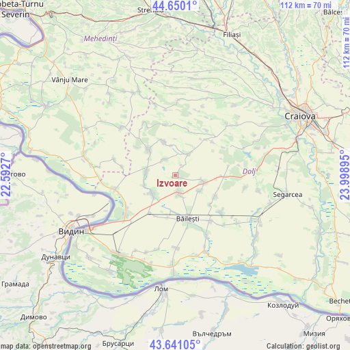
Izvoare GPS coordinates[2]
44° 8' 51.828" North, 23° 17' 44.952" East
| Map corner | latitude | longitude |
|---|---|---|
| Upper-left | 44.6501°, | 22.5927° |
| Center: | 44.14773°, | 23.29582° |
| Lower-right: | 43.64105°, | 23.99895° |
| Map W x H: | 112.2×112.2 km | = 69.7×69.7mi |
| max Lat: | 48.23793° ⇑94.5% North |
| Izvoare: | 44.14773° |
| min Lat: | ⇓5.5% South 43.65638° |
| min Long | Izvoare | max Long |
| 20.31667° | 23.29582° | 29.65403° |
| W 19.9%⇐ | ⇒80.1% E |
Elevation
Elevation of Izvoare is 130 m = 427 ft, and this is 124.9 m = 410 ft below average elevation for this country.
| Max E: |
1278 m = 4193 ft | 69.3% |
| Avg. | 254.9 m = 836 ft | |
| Izvoare | 130 m = 427 ft | |
Min E: |
-2 m = -7 ft | 30.7% |
See also: Romania elevation on elevation.city.
Geographical zone
Izvoare is located in North temperate zone (between Tropic of Cancer and the Arctic Circle). Distance of this Northern Tropic circle is 2302.8 km =1430.9 mi to South.| Distance of | km | miles | from Izvoare |
|---|---|---|---|
| North Pole | 5098.3 | 3167.9 | to North |
| Arctic Circle | 2492.4 | 1548.7 | to North |
| Tropic Cancer | 2302.8 | 1430.9 | to South |
| Equator | 4908.8 | 3050.2 | to South |


Nearby cities:
15 places around Izvoare: (largest is in red/bold)
• Caraula
5.4 km =3.4 mi,  317°
317°
• Cioroiași
14.2 km =8.8 mi,  120°
120°
• Cioroiu Nou
14.5 km =9 mi,  130°
130°
• Cornu
9.7 km =6 mi,  350°
350°
• Dobridor
10.6 km =6.6 mi,  252°
252°
• Domnu Tudor
2 km =1.2 mi,  114°
114°
• Galicea Mare
5.3 km =3.3 mi,  176°
176°
• Galiciuica
9 km =5.6 mi, 123°
• Giubega
9.2 km =5.7 mi,  104°
104°
• Moţăţei
10.5 km =6.5 mi,  226°
226°
• Orodel
10.7 km =6.6 mi,  332°
332°
• Perișor
14.3 km =8.9 mi,  91°
91°
• Pleniţa
11.8 km =7.3 mi,  310°
310°
• Unirea
9 km =5.6 mi,  271°
271°
• Vârtop
7.8 km =4.8 mi,  32°
32°
Sources, notices
• [Note1] Compared only with cities in Romania existing in our database
• [Src1] Map data: © OpenStreetMap contributors (CC-BY-SA)
• [Src2] Other city data from geonames.org with taken over terms of usage.
• [Src3] Geographical zone / Annual Mean Temperature by Robert A. Rohde @ Wikipedia
