Perișor geodata
Perișor (Dolj) is a seat of a second-order administrative division; located in Romania in Europe/Bucharest (GMT+3) time zone. With population of 1,743 people, there are 2881 cities with bigger population in this country. Compared to other cities in Romania, 94.6% of cities are located further ↑North; 77.4% of cities are located further →East and 72.3% of cities have higher elevation than Perișor. Note1


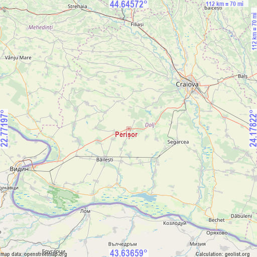
Perișor GPS coordinates[2]
44° 8' 35.916" North, 23° 28' 30.324" East
| Map corner | latitude | longitude |
|---|---|---|
| Upper-left | 44.64572°, | 22.77197° |
| Center: | 44.14331°, | 23.47509° |
| Lower-right: | 43.63659°, | 24.17822° |
| Map W x H: | 112.2×112.2 km | = 69.7×69.7mi |
| max Lat: | 48.23793° ⇑94.6% North |
| Perișor: | 44.14331° |
| min Lat: | ⇓5.4% South 43.65638° |
| min Long | Perișor | max Long |
| 20.31667° | 23.47509° | 29.65403° |
| W 22.6%⇐ | ⇒77.4% E |
Elevation
Elevation of Perișor is 119 m = 390 ft, and this is 135.9 m = 446 ft below average elevation for this country.
| Max E: |
1278 m = 4193 ft | 72.3% |
| Avg. | 254.9 m = 836 ft | |
| Perișor | 119 m = 390 ft | |
Min E: |
-2 m = -7 ft | 27.7% |
See also: Romania elevation on elevation.city.
Geographical zone
Perișor is located in North temperate zone (between Tropic of Cancer and the Arctic Circle). Distance of this Northern Tropic circle is 2302.4 km =1430.6 mi to South.| Distance of | km | miles | from Perișor |
|---|---|---|---|
| North Pole | 5098.8 | 3168.2 | to North |
| Arctic Circle | 2492.9 | 1549 | to North |
| Tropic Cancer | 2302.4 | 1430.6 | to South |
| Equator | 4908.3 | 3049.9 | to South |


Nearby cities:
15 places around Perișor: (largest is in red/bold)
• Cioroiași
7 km =4.3 mi,  196°
196°
• Cioroiu Nou
9.5 km =5.9 mi, 200°
• Domnu Tudor
12.5 km =7.8 mi,  268°
268°
• Galiciuica
8.1 km =5 mi,  236°
236°
• Giubega
5.7 km =3.5 mi,  251°
251°
• Izvoare
14.3 km =8.9 mi, 271°
• Lipovu
13.5 km =8.4 mi,  110°
110°
• Mârza
5.9 km =3.7 mi,  2°
2°
• Plopșor
12.8 km =8 mi,  337°
337°
• Radovan
11.6 km =7.2 mi,  77°
77°
• Siliştea Crucii
12.2 km =7.6 mi,  176°
176°
• Sălcuţa
12.3 km =7.6 mi, 344°
• Tencănău
9.4 km =5.8 mi,  5°
5°
• Vârtop
12.3 km =7.6 mi,  305°
305°
• Întorsura
8.7 km =5.4 mi, 113°
Sources, notices
• [Note1] Compared only with cities in Romania existing in our database
• [Src1] Map data: © OpenStreetMap contributors (CC-BY-SA)
• [Src2] Other city data from geonames.org with taken over terms of usage.
• [Src3] Geographical zone / Annual Mean Temperature by Robert A. Rohde @ Wikipedia
