Vârtop geodata
Vârtop (Dolj) is a seat of a second-order administrative division; located in Romania in Europe/Bucharest (GMT+3) time zone. With population of 1,818 people, there are 2810 cities with bigger population in this country. Compared to other cities in Romania, 93.2% of cities are located further ↑North; 79.3% of cities are located further →East and 68% of cities have higher elevation than Vârtop. Note1


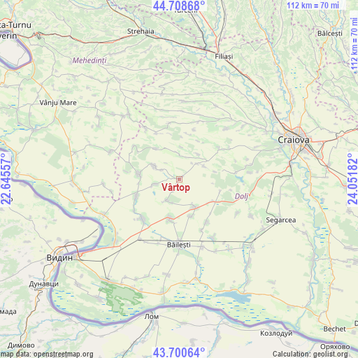
Vârtop GPS coordinates[2]
44° 12' 24.552" North, 23° 20' 55.284" East
| Map corner | latitude | longitude |
|---|---|---|
| Upper-left | 44.70868°, | 22.64557° |
| Center: | 44.20682°, | 23.34869° |
| Lower-right: | 43.70064°, | 24.05182° |
| Map W x H: | 112.1×112.1 km | = 69.7×69.7mi |
| max Lat: | 48.23793° ⇑93.2% North |
| Vârtop: | 44.20682° |
| min Lat: | ⇓6.8% South 43.65638° |
| min Long | Vârtop | max Long |
| 20.31667° | 23.34869° | 29.65403° |
| W 20.7%⇐ | ⇒79.3% E |
Elevation
Elevation of Vârtop is 135 m = 443 ft, and this is 119.9 m = 393 ft below average elevation for this country.
| Max E: |
1278 m = 4193 ft | 68% |
| Avg. | 254.9 m = 836 ft | |
| Vârtop | 135 m = 443 ft | |
Min E: |
-2 m = -7 ft | 32% |
See also: Romania elevation on elevation.city.
Geographical zone
Vârtop is located in North temperate zone (between Tropic of Cancer and the Arctic Circle). Distance of this Northern Tropic circle is 2309.4 km =1435 mi to South.| Distance of | km | miles | from Vârtop |
|---|---|---|---|
| North Pole | 5091.7 | 3163.8 | to North |
| Arctic Circle | 2485.8 | 1544.6 | to North |
| Tropic Cancer | 2309.4 | 1435 | to South |
| Equator | 4915.3 | 3054.2 | to South |


Nearby cities:
15 places around Vârtop: (largest is in red/bold)
• Bucovicior
10.3 km =6.4 mi,  2°
2°
• Caraula
8.3 km =5.2 mi,  251°
251°
• Cornu
6.6 km =4.1 mi,  297°
297°
• Călugărei
12.2 km =7.6 mi,  322°
322°
• Domnu Tudor
7.8 km =4.8 mi,  197°
197°
• Galiciuica
12 km =7.5 mi,  163°
163°
• Giubega
10 km =6.2 mi,  151°
151°
• Gubaucea
8.2 km =5.1 mi,  357°
357°
• Izvoare
7.8 km =4.8 mi,  212°
212°
• Mârza
10.4 km =6.5 mi,  96°
96°
• Orodel
9.7 km =6 mi,  287°
287°
• Plopșor
7.1 km =4.4 mi,  47°
47°
• Sălcuţa
8.3 km =5.2 mi, 54°
• Tencănău
11.2 km =7 mi,  77°
77°
• Vela
10.1 km =6.3 mi,  32°
32°
Sources, notices
• [Note1] Compared only with cities in Romania existing in our database
• [Src1] Map data: © OpenStreetMap contributors (CC-BY-SA)
• [Src2] Other city data from geonames.org with taken over terms of usage.
• [Src3] Geographical zone / Annual Mean Temperature by Robert A. Rohde @ Wikipedia
