Ibăneşti geodata
Ibăneşti (Mureş) is a populated place; located in Romania in Europe/Bucharest (GMT+3) time zone. With population of 4,434 people, there are 976 cities with bigger population in this country. Compared to other cities in Romania, 73.2% of cities are located further ↓South; 53.6% of cities are located further →East and 88.6% of cities have lower elevation than Ibăneşti. Note1


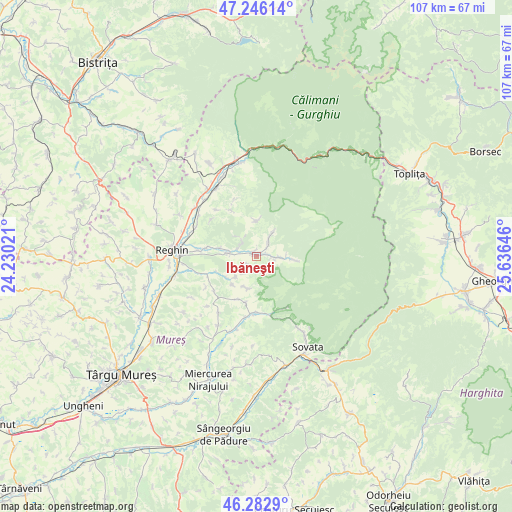
Ibăneşti GPS coordinates[2]
46° 46' 0.012" North, 24° 55' 59.988" East
| Map corner | latitude | longitude |
|---|---|---|
| Upper-left | 47.24614°, | 24.23021° |
| Center: | 46.76667°, | 24.93333° |
| Lower-right: | 46.2829°, | 25.63646° |
| Map W x H: | 107.1×107.1 km | = 66.5×66.5mi |
| max Lat: | 48.23793° ⇑26.8% North |
| Ibăneşti: | 46.76667° |
| min Lat: | ⇓73.2% South 43.65638° |
| min Long | Ibăneşti | max Long |
| 20.31667° | 24.93333° | 29.65403° |
| W 46.4%⇐ | ⇒53.6% E |
Elevation
Elevation of Ibăneşti is 491 m = 1611 ft, and this is 236.1 m = 775 ft above average elevation for this country.
| Max E: |
1278 m = 4193 ft | 11.4% |
| Ibăneşti | 491 m 1611 ft | |
| Avg. | 254.9 m = 836 ft | |
Min E: |
-2 m = -7 ft | 88.6% |
See also: Romania elevation on elevation.city.
Geographical zone
Ibăneşti is located in North temperate zone (between Tropic of Cancer and the Arctic Circle). Distance of this North polar circle is 2201.2 km =1367.8 mi to North.| Distance of | km | miles | from Ibăneşti |
|---|---|---|---|
| North Pole | 4807.1 | 2987 | to North |
| Arctic Circle | 2201.2 | 1367.8 | to North |
| Tropic Cancer | 2594 | 1611.8 | to South |
| Equator | 5200 | 3231.1 | to South |


Nearby cities:
15 places around Ibăneşti: (largest is in red/bold)
• Beica de Jos
10.8 km =6.7 mi,  249°
249°
• Cașva
4.2 km =2.6 mi,  298°
298°
• Chiheru de Jos
10 km =6.2 mi,  202°
202°
• Călugăreni
15.7 km =9.8 mi, 195°
• Eremitu
11.1 km =6.9 mi,  180°
180°
• Gurghiu
6.3 km =3.9 mi,  270°
270°
• Hodac
1.3 km =0.8 mi, 270°
• Ibănești-Pădure
4.2 km =2.6 mi,  101°
101°
• Ideciu de Jos
14.4 km =8.9 mi,  284°
284°
• Jabenița
10.6 km =6.6 mi, 280°
• Mătrici
12.9 km =8 mi,  190°
190°
• Orșova
2.4 km =1.5 mi,  218°
218°
• Solovăstru
12.7 km =7.9 mi, 270°
• Toaca
4.4 km =2.7 mi,  32°
32°
• Urisiu de Sus
6.9 km =4.3 mi, 194°
Sources, notices
• [Note1] Compared only with cities in Romania existing in our database
• [Src1] Map data: © OpenStreetMap contributors (CC-BY-SA)
• [Src2] Other city data from geonames.org with taken over terms of usage.
• [Src3] Geographical zone / Annual Mean Temperature by Robert A. Rohde @ Wikipedia
