Hida geodata
Hida (Sălaj) is a seat of a second-order administrative division; located in Romania in Europe/Bucharest (GMT+3) time zone. With population of 3,083 people, there are 1706 cities with bigger population in this country. Compared to other cities in Romania, 80.6% of cities are located further ↓South; 80.4% of cities are located further →East and 69.9% of cities have lower elevation than Hida. Note1


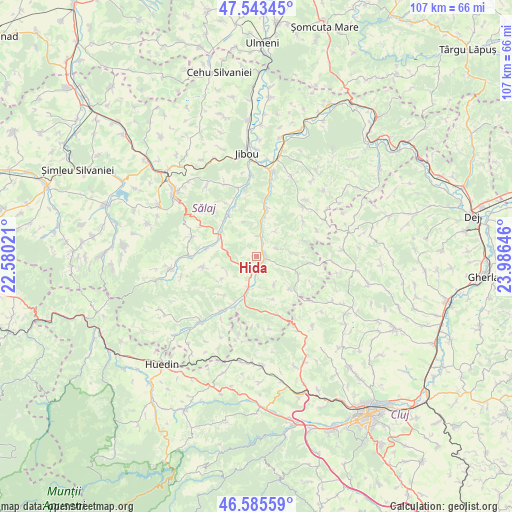
Hida GPS coordinates[2]
47° 4' 0.012" North, 23° 16' 59.988" East
| Map corner | latitude | longitude |
|---|---|---|
| Upper-left | 47.54345°, | 22.58021° |
| Center: | 47.06667°, | 23.28333° |
| Lower-right: | 46.58559°, | 23.98646° |
| Map W x H: | 106.5×106.5 km | = 66.2×66.2mi |
| max Lat: | 48.23793° ⇑19.4% North |
| Hida: | 47.06667° |
| min Lat: | ⇓80.6% South 43.65638° |
| min Long | Hida | max Long |
| 20.31667° | 23.28333° | 29.65403° |
| W 19.6%⇐ | ⇒80.4% E |
Elevation
Elevation of Hida is 320 m = 1050 ft, and this is 65.1 m = 214 ft above average elevation for this country.
| Max E: |
1278 m = 4193 ft | 30.1% |
| Hida | 320 m 1050 ft | |
| Avg. | 254.9 m = 836 ft | |
Min E: |
-2 m = -7 ft | 69.9% |
See also: Romania elevation on elevation.city.
Geographical zone
Hida is located in North temperate zone (between Tropic of Cancer and the Arctic Circle). Distance of this North polar circle is 2167.9 km =1347.1 mi to North.| Distance of | km | miles | from Hida |
|---|---|---|---|
| North Pole | 4773.7 | 2966.2 | to North |
| Arctic Circle | 2167.9 | 1347.1 | to North |
| Tropic Cancer | 2627.4 | 1632.6 | to South |
| Equator | 5233.3 | 3251.8 | to South |


Nearby cities:
15 places around Hida: (largest is in red/bold)
• Agrij
13.9 km =8.6 mi,  270°
270°
• Bălan
10.2 km =6.3 mi,  12°
12°
• Chechiș
12.2 km =7.6 mi, 9°
• Chendrea
6.3 km =3.9 mi, 10°
• Creaca
15 km =9.3 mi,  350°
350°
• Cuzăplac
12.8 km =8 mi,  209°
209°
• Dragu
10.4 km =6.5 mi,  122°
122°
• Gâlgău Almaşului
15.3 km =9.5 mi, 14°
• Gârbou
14.7 km =9.1 mi,  50°
50°
• Jac
12.9 km =8 mi,  330°
330°
• Păușa
10.5 km =6.5 mi,  281°
281°
• Românaşi
8.4 km =5.2 mi,  296°
296°
• Sânmihaiu Almaşului
5.7 km =3.5 mi,  167°
167°
• Treznea
13.2 km =8.2 mi,  286°
286°
• Zimbor
7.5 km =4.7 mi,  189°
189°
Sources, notices
• [Note1] Compared only with cities in Romania existing in our database
• [Src1] Map data: © OpenStreetMap contributors (CC-BY-SA)
• [Src2] Other city data from geonames.org with taken over terms of usage.
• [Src3] Geographical zone / Annual Mean Temperature by Robert A. Rohde @ Wikipedia
