Agrij geodata
Agrij (Sălaj) is a seat of a second-order administrative division; located in Romania in Europe/Bucharest (GMT+3) time zone. With population of 1,374 people, there are 3385 cities with bigger population in this country. Compared to other cities in Romania, 80.7% of cities are located further ↓South; 83% of cities are located further →East and 67.2% of cities have lower elevation than Agrij. Note1


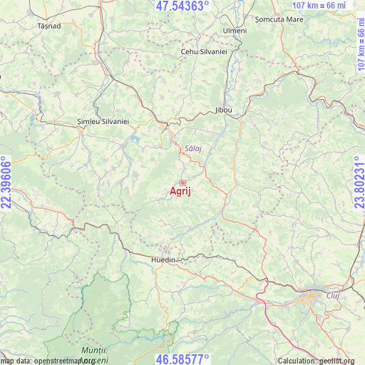
Agrij GPS coordinates[2]
47° 4' 0.66" North, 23° 5' 57.048" East
| Map corner | latitude | longitude |
|---|---|---|
| Upper-left | 47.54363°, | 22.39606° |
| Center: | 47.06685°, | 23.09918° |
| Lower-right: | 46.58577°, | 23.80231° |
| Map W x H: | 106.5×106.5 km | = 66.2×66.2mi |
| max Lat: | 48.23793° ⇑19.3% North |
| Agrij: | 47.06685° |
| min Lat: | ⇓80.7% South 43.65638° |
| min Long | Agrij | max Long |
| 20.31667° | 23.09918° | 29.65403° |
| W 17%⇐ | ⇒83% E |
Elevation
Elevation of Agrij is 303 m = 994 ft, and this is 48.1 m = 158 ft above average elevation for this country.
| Max E: |
1278 m = 4193 ft | 32.8% |
| Agrij | 303 m 994 ft | |
| Avg. | 254.9 m = 836 ft | |
Min E: |
-2 m = -7 ft | 67.2% |
See also: Romania elevation on elevation.city.
Geographical zone
Agrij is located in North temperate zone (between Tropic of Cancer and the Arctic Circle). Distance of this North polar circle is 2167.8 km =1347 mi to North.| Distance of | km | miles | from Agrij |
|---|---|---|---|
| North Pole | 4773.7 | 2966.2 | to North |
| Arctic Circle | 2167.8 | 1347 | to North |
| Tropic Cancer | 2627.4 | 1632.6 | to South |
| Equator | 5233.3 | 3251.8 | to South |


Nearby cities:
15 places around Agrij: (largest is in red/bold)
• Aghireș
12.2 km =7.6 mi,  329°
329°
• Almaşu
13.7 km =8.5 mi,  170°
170°
• Buciumi
4.5 km =2.8 mi,  213°
213°
• Cuzăplac
13.5 km =8.4 mi,  145°
145°
• Fildu de Jos
15 km =9.3 mi,  189°
189°
• Hida
13.9 km =8.6 mi,  90°
90°
• Jac
13.4 km =8.3 mi,  33°
33°
• Meseşenii de Jos
12.7 km =7.9 mi,  316°
316°
• Meseșenii de Sus
10.9 km =6.8 mi,  307°
307°
• Moigrad-Porolissum
14.9 km =9.3 mi,  13°
13°
• Păușa
4.2 km =2.6 mi,  60°
60°
• Românaşi
7.4 km =4.6 mi, 59°
• Stârciu
13.8 km =8.6 mi,  279°
279°
• Treznea
3.9 km =2.4 mi,  19°
19°
• Zimbor
14.7 km =9.1 mi,  120°
120°
Sources, notices
• [Note1] Compared only with cities in Romania existing in our database
• [Src1] Map data: © OpenStreetMap contributors (CC-BY-SA)
• [Src2] Other city data from geonames.org with taken over terms of usage.
• [Src3] Geographical zone / Annual Mean Temperature by Robert A. Rohde @ Wikipedia
