Hăbeni geodata
Hăbeni (Dâmboviţa) is a populated place; located in Romania in Europe/Bucharest (GMT+3) time zone. With population of 1,477 people, there are 3219 cities with bigger population in this country. Compared to other cities in Romania, 74.7% of cities are located further ↑North; 56.5% of cities are located further ←West and 51.1% of cities have higher elevation than Hăbeni. Note1


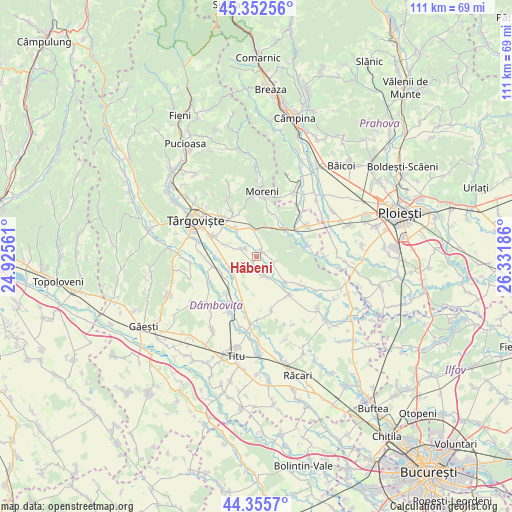
Hăbeni GPS coordinates[2]
44° 51' 22.644" North, 25° 37' 43.428" East
| Map corner | latitude | longitude |
|---|---|---|
| Upper-left | 45.35256°, | 24.92561° |
| Center: | 44.85629°, | 25.62873° |
| Lower-right: | 44.3557°, | 26.33186° |
| Map W x H: | 110.8×110.8 km | = 68.8×68.8mi |
| max Lat: | 48.23793° ⇑74.7% North |
| Hăbeni: | 44.85629° |
| min Lat: | ⇓25.3% South 43.65638° |
| min Long | Hăbeni | max Long |
| 20.31667° | 25.62873° | 29.65403° |
| W 56.5%⇐ | ⇒43.5% E |
Elevation
Elevation of Hăbeni is 206 m = 676 ft, and this is 48.9 m = 160 ft below average elevation for this country.
| Max E: |
1278 m = 4193 ft | 51.1% |
| Avg. | 254.9 m = 836 ft | |
| Hăbeni | 206 m = 676 ft | |
Min E: |
-2 m = -7 ft | 48.9% |
See also: Romania elevation on elevation.city.
Geographical zone
Hăbeni is located in North temperate zone (between Tropic of Cancer and the Arctic Circle). Distance of this Northern Tropic circle is 2381.6 km =1479.9 mi to South.| Distance of | km | miles | from Hăbeni |
|---|---|---|---|
| North Pole | 5019.5 | 3119 | to North |
| Arctic Circle | 2413.6 | 1499.7 | to North |
| Tropic Cancer | 2381.6 | 1479.9 | to South |
| Equator | 4987.6 | 3099.1 | to South |


Nearby cities:
15 places around Hăbeni: (largest is in red/bold)
• Adânca
7.5 km =4.7 mi,  348°
348°
• Brăteștii de Jos
8.5 km =5.3 mi,  242°
242°
• Bucşani
2 km =1.2 mi,  55°
55°
• Bungetu
7.3 km =4.5 mi,  258°
258°
• Băleni Sârbi
4.4 km =2.7 mi,  175°
175°
• Cazaci
8.5 km =5.3 mi,  224°
224°
• Comişani
4.7 km =2.9 mi,  310°
310°
• I. L. Caragiale
8.3 km =5.2 mi,  44°
44°
• Ilfoveni
6.2 km =3.9 mi, 238°
• Lazuri
6.7 km =4.2 mi,  291°
291°
• Mija
7.4 km =4.6 mi,  30°
30°
• Mărcești
8.5 km =5.3 mi,  131°
131°
• Racovița
2 km =1.2 mi,  198°
198°
• Rățoaia
4.5 km =2.8 mi,  102°
102°
• Săcueni
7.5 km =4.7 mi,  323°
323°
Sources, notices
• [Note1] Compared only with cities in Romania existing in our database
• [Src1] Map data: © OpenStreetMap contributors (CC-BY-SA)
• [Src2] Other city data from geonames.org with taken over terms of usage.
• [Src3] Geographical zone / Annual Mean Temperature by Robert A. Rohde @ Wikipedia
