Gottlob geodata
Gottlob (Timiş) is a seat of a second-order administrative division; located in Romania in Europe/Bucharest (GMT+3) time zone. With population of 1,769 people, there are 2850 cities with bigger population in this country. Compared to other cities in Romania, 53.8% of cities are located further ↓South; 99.8% of cities are located further →East and 83.1% of cities have higher elevation than Gottlob. Note1


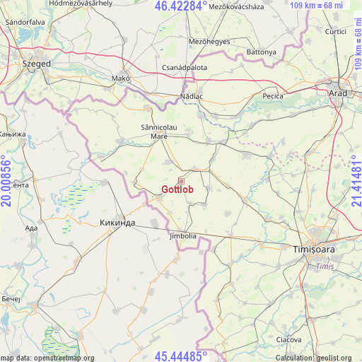
Gottlob GPS coordinates[2]
45° 56' 9.6" North, 20° 42' 42.048" East
| Map corner | latitude | longitude |
|---|---|---|
| Upper-left | 46.42284°, | 20.00856° |
| Center: | 45.936°, | 20.71168° |
| Lower-right: | 45.44485°, | 21.41481° |
| Map W x H: | 108.7×108.7 km | = 67.5×67.5mi |
| max Lat: | 48.23793° ⇑46.2% North |
| Gottlob: | 45.936° |
| min Lat: | ⇓53.8% South 43.65638° |
| min Long | Gottlob | max Long |
| 20.31667° | 20.71168° | 29.65403° |
| W 0.2%⇐ | ⇒99.8% E |
Elevation
Elevation of Gottlob is 84 m = 276 ft, and this is 170.9 m = 561 ft below average elevation for this country.
| Max E: |
1278 m = 4193 ft | 83.1% |
| Avg. | 254.9 m = 836 ft | |
| Gottlob | 84 m = 276 ft | |
Min E: |
-2 m = -7 ft | 16.9% |
See also: Romania elevation on elevation.city.
Geographical zone
Gottlob is located in North temperate zone (between Tropic of Cancer and the Arctic Circle). Distance of this North polar circle is 2293.6 km =1425.2 mi to North.| Distance of | km | miles | from Gottlob |
|---|---|---|---|
| North Pole | 4899.5 | 3044.4 | to North |
| Arctic Circle | 2293.6 | 1425.2 | to North |
| Tropic Cancer | 2501.7 | 1554.5 | to South |
| Equator | 5107.6 | 3173.7 | to South |


Nearby cities:
15 places around Gottlob: (largest is in red/bold)
• Bulgăruș
8.7 km =5.4 mi,  102°
102°
• Comloşu Mare
8.3 km =5.2 mi,  232°
232°
• Comloșu Mic
9.9 km =6.2 mi,  199°
199°
• Grabăț
6.8 km =4.2 mi,  159°
159°
• Lenauheim
9.8 km =6.1 mi,  136°
136°
• Lovrin
5.8 km =3.6 mi,  51°
51°
• Lunga
11 km =6.8 mi,  237°
237°
• Nerău
12.2 km =7.6 mi,  287°
287°
• Pesac
11.6 km =7.2 mi,  55°
55°
• Saravale
15 km =9.3 mi,  8°
8°
• Sânpetru Mare
14.7 km =9.1 mi,  34°
34°
• Teremia Mare
14.4 km =8.9 mi,  269°
269°
• Tomnatic
7 km =4.3 mi,  326°
326°
• Uihei
11.9 km =7.4 mi, 103°
• Şandra
13.9 km =8.6 mi, 95°
Sources, notices
• [Note1] Compared only with cities in Romania existing in our database
• [Src1] Map data: © OpenStreetMap contributors (CC-BY-SA)
• [Src2] Other city data from geonames.org with taken over terms of usage.
• [Src3] Geographical zone / Annual Mean Temperature by Robert A. Rohde @ Wikipedia
