Şandra geodata
Şandra (Timiş) is a seat of a second-order administrative division; located in Romania in Europe/Bucharest (GMT+3) time zone. In our database, there are 7076 cities with bigger population. Compared to other cities in Romania, 53.4% of cities are located further ↓South; 99.5% of cities are located further →East and 81.1% of cities have higher elevation than Şandra. Note1


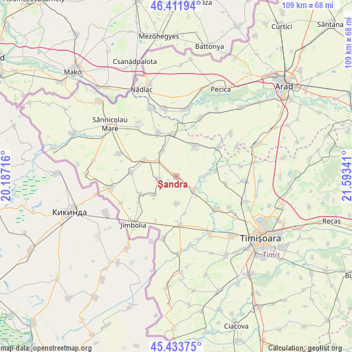
Şandra GPS coordinates[2]
45° 55' 30" North, 20° 53' 25.008" East
| Map corner | latitude | longitude |
|---|---|---|
| Upper-left | 46.41194°, | 20.18716° |
| Center: | 45.925°, | 20.89028° |
| Lower-right: | 45.43375°, | 21.59341° |
| Map W x H: | 108.8×108.8 km | = 67.6×67.6mi |
| max Lat: | 48.23793° ⇑46.6% North |
| Şandra: | 45.925° |
| min Lat: | ⇓53.4% South 43.65638° |
| min Long | Şandra | max Long |
| 20.31667° | 20.89028° | 29.65403° |
| W 0.5%⇐ | ⇒99.5% E |
Elevation
Elevation of Şandra is 91 m = 299 ft, and this is 163.9 m = 538 ft below average elevation for this country.
| Max E: |
1278 m = 4193 ft | 81.1% |
| Avg. | 254.9 m = 836 ft | |
| Şandra | 91 m = 299 ft | |
Min E: |
-2 m = -7 ft | 18.9% |
See also: Romania elevation on elevation.city.
Geographical zone
Şandra is located in North temperate zone (between Tropic of Cancer and the Arctic Circle). Distance of this North polar circle is 2294.8 km =1425.9 mi to North.| Distance of | km | miles | from Şandra |
|---|---|---|---|
| North Pole | 4900.7 | 3045.2 | to North |
| Arctic Circle | 2294.8 | 1425.9 | to North |
| Tropic Cancer | 2500.5 | 1553.7 | to South |
| Equator | 5106.4 | 3173 | to South |


Nearby cities:
15 places around Şandra: (largest is in red/bold)
• Biled
6.8 km =4.2 mi,  128°
128°
• Bulgăruș
5.3 km =3.3 mi,  263°
263°
• Cărpiniş
15.4 km =9.6 mi,  175°
175°
• Gottlob
13.9 km =8.6 mi,  275°
275°
• Grabăț
12.6 km =7.8 mi,  245°
245°
• Iecea Mare
8.3 km =5.2 mi, 178°
• Iecea Mică
11.8 km =7.3 mi,  167°
167°
• Lenauheim
9.2 km =5.7 mi,  229°
229°
• Lovrin
10.4 km =6.5 mi,  297°
297°
• Periam
14 km =8.7 mi,  352°
352°
• Pesac
9 km =5.6 mi,  331°
331°
• Satchinez
11.7 km =7.3 mi,  83°
83°
• Sânpetru Mare
14.5 km =9 mi,  337°
337°
• Uihei
2.6 km =1.6 mi,  235°
235°
• Variaş
11.2 km =7 mi,  24°
24°
Sources, notices
• [Note1] Compared only with cities in Romania existing in our database
• [Src1] Map data: © OpenStreetMap contributors (CC-BY-SA)
• [Src2] Other city data from geonames.org with taken over terms of usage.
• [Src3] Geographical zone / Annual Mean Temperature by Robert A. Rohde @ Wikipedia
