Giulvăz geodata
Giulvăz (Timiş) is a seat of a second-order administrative division; located in Romania in Europe/Bucharest (GMT+3) time zone. With population of 2,992 people, there are 1770 cities with bigger population in this country. Compared to other cities in Romania, 54.4% of cities are located further ↑North; 99.3% of cities are located further →East and 84.7% of cities have higher elevation than Giulvăz. Note1


Giulvăz GPS coordinates[2]
45° 32' 56.004" North, 20° 59' 3.984" East
| Map corner | latitude | longitude |
|---|---|---|
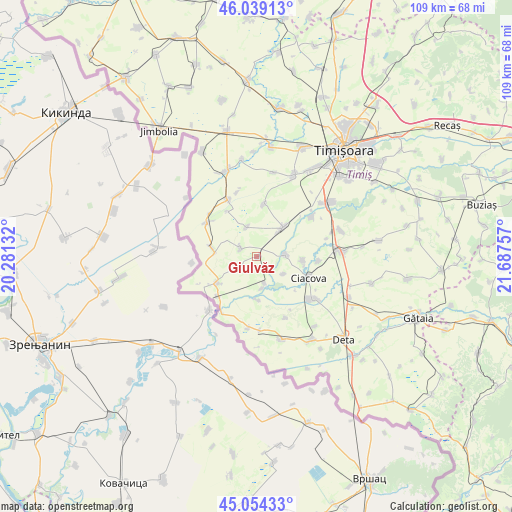
| Upper-left | 46.03913°, | 20.28132° |
| Center: | 45.54889°, | 20.98444° |
| Lower-right: | 45.05433°, | 21.68757° |
| Map W x H: | 109.5×109.5 km | = 68×68mi |
| max Lat: | 48.23793° ⇑54.4% North |
| Giulvăz: | 45.54889° |
| min Lat: | ⇓45.6% South 43.65638° |
| min Long | Giulvăz | max Long |
| 20.31667° | 20.98444° | 29.65403° |
| W 0.7%⇐ | ⇒99.3% E |
Elevation
Elevation of Giulvăz is 79 m = 259 ft, and this is 175.9 m = 577 ft below average elevation for this country.
| Max E: |
1278 m = 4193 ft | 84.7% |
| Avg. | 254.9 m = 836 ft | |
| Giulvăz | 79 m = 259 ft | |
Min E: |
-2 m = -7 ft | 15.3% |
See also: Romania elevation on elevation.city.
Geographical zone
Giulvăz is located in North temperate zone (between Tropic of Cancer and the Arctic Circle). Distance of this North polar circle is 2336.6 km =1451.9 mi to North.| Distance of | km | miles | from Giulvăz |
|---|---|---|---|
| North Pole | 4942.5 | 3071.1 | to North |
| Arctic Circle | 2336.6 | 1451.9 | to North |
| Tropic Cancer | 2458.6 | 1527.7 | to South |
| Equator | 5064.6 | 3147 | to South |


Nearby cities:
15 places around Giulvăz: (largest is in red/bold)
• Cebza
6.4 km =4 mi,  86°
86°
• Ciacova
12.1 km =7.5 mi,  112°
112°
• Crai Nou
6.9 km =4.3 mi,  169°
169°
• Diniaș
11.5 km =7.1 mi,  8°
8°
• Foeni
10.1 km =6.3 mi,  236°
236°
• Iohanisfeld
9.6 km =6 mi,  281°
281°
• Ivanda
3.8 km =2.4 mi,  299°
299°
• Obad
13.5 km =8.4 mi, 93°
• Otelec
12.8 km =8 mi, 304°
• Peciu Nou
8.6 km =5.3 mi,  41°
41°
• Petroman
10.1 km =6.3 mi, 94°
• Pustiniș
13.7 km =8.5 mi,  313°
313°
• Rudna
5.9 km =3.7 mi,  161°
161°
• Sânmartinu Sârbesc
6.6 km =4.1 mi,  342°
342°
• Uivar
13.6 km =8.5 mi,  333°
333°
Sources, notices
• [Note1] Compared only with cities in Romania existing in our database
• [Src1] Map data: © OpenStreetMap contributors (CC-BY-SA)
• [Src2] Other city data from geonames.org with taken over terms of usage.
• [Src3] Geographical zone / Annual Mean Temperature by Robert A. Rohde @ Wikipedia
