Ghergheşti geodata
Ghergheşti (Vaslui) is a seat of a second-order administrative division; located in Romania in Europe/Bucharest (GMT+3) time zone. With population of 2,785 people, there are 1926 cities with bigger population in this country. Compared to other cities in Romania, 67.1% of cities are located further ↓South; 91% of cities are located further ←West and 56.7% of cities have lower elevation than Ghergheşti. Note1


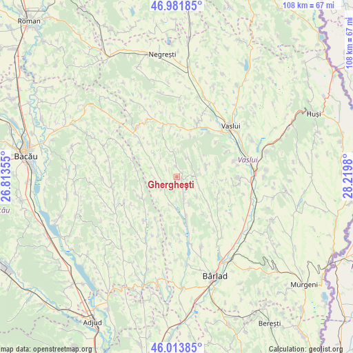
Ghergheşti GPS coordinates[2]
46° 30' 0" North, 27° 31' 0.012" East
| Map corner | latitude | longitude |
|---|---|---|
| Upper-left | 46.98185°, | 26.81355° |
| Center: | 46.5°, | 27.51667° |
| Lower-right: | 46.01385°, | 28.2198° |
| Map W x H: | 107.6×107.6 km | = 66.9×66.9mi |
| max Lat: | 48.23793° ⇑32.9% North |
| Ghergheşti: | 46.5° |
| min Lat: | ⇓67.1% South 43.65638° |
| min Long | Ghergheşti | max Long |
| 20.31667° | 27.51667° | 29.65403° |
| W 91%⇐ | ⇒9% E |
Elevation
Elevation of Ghergheşti is 246 m = 807 ft, and this is 8.9 m = 29 ft below average elevation for this country.
| Max E: |
1278 m = 4193 ft | 43.3% |
| Avg. | 254.9 m = 836 ft | |
| Ghergheşti | 246 m = 807 ft | |
Min E: |
-2 m = -7 ft | 56.7% |
See also: Romania elevation on elevation.city.
Geographical zone
Ghergheşti is located in North temperate zone (between Tropic of Cancer and the Arctic Circle). Distance of this North polar circle is 2230.9 km =1386.2 mi to North.| Distance of | km | miles | from Ghergheşti |
|---|---|---|---|
| North Pole | 4836.7 | 3005.4 | to North |
| Arctic Circle | 2230.9 | 1386.2 | to North |
| Tropic Cancer | 2564.4 | 1593.4 | to South |
| Equator | 5170.3 | 3212.7 | to South |


Nearby cities:
15 places around Ghergheşti: (largest is in red/bold)
• Alexandru Vlăhuţă
12.9 km =8 mi,  136°
136°
• Avrămești
13 km =8.1 mi,  295°
295°
• Barcana
11.9 km =7.4 mi,  263°
263°
• Bogdana
9.4 km =5.8 mi,  71°
71°
• Bogdăniţa
13.9 km =8.6 mi,  113°
113°
• Florești
6.8 km =4.2 mi,  33°
33°
• Gârdești
7.5 km =4.7 mi,  317°
317°
• Hălărești
12.1 km =7.5 mi,  165°
165°
• Iana
13.2 km =8.2 mi, 168°
• Oprișița
13.1 km =8.1 mi,  18°
18°
• Poieneşti
13 km =8.1 mi,  5°
5°
• Puieşti
9.4 km =5.8 mi,  187°
187°
• Răchitoasa
13.7 km =8.5 mi,  237°
237°
• Siliștea
8.6 km =5.3 mi,  159°
159°
• Voineşti
10.7 km =6.6 mi,  314°
314°
Sources, notices
• [Note1] Compared only with cities in Romania existing in our database
• [Src1] Map data: © OpenStreetMap contributors (CC-BY-SA)
• [Src2] Other city data from geonames.org with taken over terms of usage.
• [Src3] Geographical zone / Annual Mean Temperature by Robert A. Rohde @ Wikipedia
