Bogdana geodata
Bogdana (Vaslui) is a seat of a second-order administrative division; located in Romania in Europe/Bucharest (GMT+3) time zone. With population of 627 people, there are 6031 cities with bigger population in this country. Compared to other cities in Romania, 67.7% of cities are located further ↓South; 92.4% of cities are located further ←West and 51.5% of cities have higher elevation than Bogdana. Note1


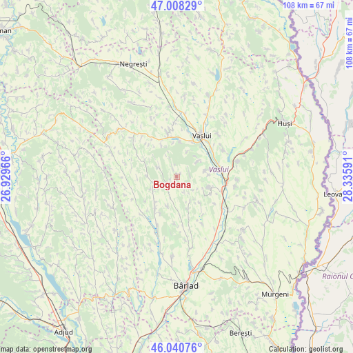
Bogdana GPS coordinates[2]
46° 31' 36.048" North, 27° 37' 58.008" East
| Map corner | latitude | longitude |
|---|---|---|
| Upper-left | 47.00829°, | 26.92966° |
| Center: | 46.52668°, | 27.63278° |
| Lower-right: | 46.04076°, | 28.33591° |
| Map W x H: | 107.6×107.6 km | = 66.9×66.9mi |
| max Lat: | 48.23793° ⇑32.3% North |
| Bogdana: | 46.52668° |
| min Lat: | ⇓67.7% South 43.65638° |
| min Long | Bogdana | max Long |
| 20.31667° | 27.63278° | 29.65403° |
| W 92.4%⇐ | ⇒7.6% E |
Elevation
Elevation of Bogdana is 204 m = 669 ft, and this is 50.9 m = 167 ft below average elevation for this country.
| Max E: |
1278 m = 4193 ft | 51.5% |
| Avg. | 254.9 m = 836 ft | |
| Bogdana | 204 m = 669 ft | |
Min E: |
-2 m = -7 ft | 48.5% |
See also: Romania elevation on elevation.city.
Geographical zone
Bogdana is located in North temperate zone (between Tropic of Cancer and the Arctic Circle). Distance of this North polar circle is 2227.9 km =1384.4 mi to North.| Distance of | km | miles | from Bogdana |
|---|---|---|---|
| North Pole | 4833.8 | 3003.6 | to North |
| Arctic Circle | 2227.9 | 1384.4 | to North |
| Tropic Cancer | 2567.4 | 1595.3 | to South |
| Equator | 5173.3 | 3214.5 | to South |


Nearby cities:
15 places around Bogdana: (largest is in red/bold)
• Alexandru Vlăhuţă
12.2 km =7.6 mi,  179°
179°
• Bogdănești
11.2 km =7 mi,  139°
139°
• Bogdăniţa
9.4 km =5.8 mi,  155°
155°
• Chițoc
8.3 km =5.2 mi,  22°
22°
• Corbu
8.5 km =5.3 mi,  42°
42°
• Costeşti
9.4 km =5.8 mi,  108°
108°
• Deleni
9.3 km =5.8 mi,  73°
73°
• Florești
5.8 km =3.6 mi,  297°
297°
• Ghergheşti
9.4 km =5.8 mi,  251°
251°
• Lipovăţ
6.8 km =4.2 mi,  49°
49°
• Oprișița
10.5 km =6.5 mi,  333°
333°
• Poieneşti
12.6 km =7.8 mi,  322°
322°
• Pușcași
10.6 km =6.6 mi,  5°
5°
• Rediu
12.8 km =8 mi, 21°
• Siliștea
12.5 km =7.8 mi,  207°
207°
Sources, notices
• [Note1] Compared only with cities in Romania existing in our database
• [Src1] Map data: © OpenStreetMap contributors (CC-BY-SA)
• [Src2] Other city data from geonames.org with taken over terms of usage.
• [Src3] Geographical zone / Annual Mean Temperature by Robert A. Rohde @ Wikipedia
