Frăteşti geodata
Frăteşti (Giurgiu) is a seat of a second-order administrative division; located in Romania in Europe/Bucharest (GMT+3) time zone. With population of 5,527 people, there are 632 cities with bigger population in this country. Compared to other cities in Romania, 97.4% of cities are located further ↑North; 62.2% of cities are located further ←West and 97% of cities have higher elevation than Frăteşti. Note1


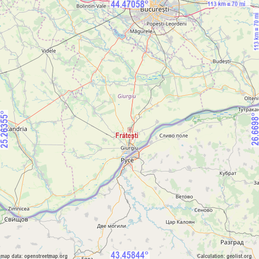
Frăteşti GPS coordinates[2]
43° 58' 0.012" North, 25° 58' 0.012" East
| Map corner | latitude | longitude |
|---|---|---|
| Upper-left | 44.47058°, | 25.26355° |
| Center: | 43.96667°, | 25.96667° |
| Lower-right: | 43.45844°, | 26.6698° |
| Map W x H: | 112.5×112.5 km | = 69.9×69.9mi |
| max Lat: | 48.23793° ⇑97.4% North |
| Frăteşti: | 43.96667° |
| min Lat: | ⇓2.6% South 43.65638° |
| min Long | Frăteşti | max Long |
| 20.31667° | 25.96667° | 29.65403° |
| W 62.2%⇐ | ⇒37.8% E |
Elevation
Elevation of Frăteşti is 23 m = 75 ft, and this is 231.9 m = 761 ft below average elevation for this country.
| Max E: |
1278 m = 4193 ft | 97% |
| Avg. | 254.9 m = 836 ft | |
| Frăteşti | 23 m = 75 ft | |
Min E: |
-2 m = -7 ft | 3% |
See also: Romania elevation on elevation.city.
Geographical zone
Frăteşti is located in North temperate zone (between Tropic of Cancer and the Arctic Circle). Distance of this Northern Tropic circle is 2282.7 km =1418.4 mi to South.| Distance of | km | miles | from Frăteşti |
|---|---|---|---|
| North Pole | 5118.4 | 3180.4 | to North |
| Arctic Circle | 2512.5 | 1561.2 | to North |
| Tropic Cancer | 2282.7 | 1418.4 | to South |
| Equator | 4888.6 | 3037.6 | to South |


Nearby cities:
15 places around Frăteşti: (largest is in red/bold)
• Braniștea
5.7 km =3.5 mi,  93°
93°
• Bălanu
6.5 km =4 mi,  215°
215°
• Băneasa
11.8 km =7.3 mi,  41°
41°
• Cetatea
3.1 km =1.9 mi,  235°
235°
• Daia
3.9 km =2.4 mi,  19°
19°
• Frasinu
8 km =5 mi,  34°
34°
• Ghizdaru
7.8 km =4.8 mi, 239°
• Giurgiu
8.9 km =5.5 mi,  182°
182°
• Gostinu
12.6 km =7.8 mi,  72°
72°
• Oinacu
4.4 km =2.7 mi,  114°
114°
• Oncești
7 km =4.3 mi,  260°
260°
• Plopșoru
5.5 km =3.4 mi, 22°
• Remuș
2.9 km =1.8 mi,  157°
157°
• Slobozia
14 km =8.7 mi,  202°
202°
• Stăneşti
12 km =7.5 mi, 242°
Sources, notices
• [Note1] Compared only with cities in Romania existing in our database
• [Src1] Map data: © OpenStreetMap contributors (CC-BY-SA)
• [Src2] Other city data from geonames.org with taken over terms of usage.
• [Src3] Geographical zone / Annual Mean Temperature by Robert A. Rohde @ Wikipedia
