Braniștea geodata
Braniștea (Giurgiu) is a populated place; located in Romania in Europe/Bucharest (GMT+3) time zone. With population of 2,014 people, there are 2584 cities with bigger population in this country. Compared to other cities in Romania, 97.5% of cities are located further ↑North; 63.8% of cities are located further ←West and 97.3% of cities have higher elevation than Braniștea. Note1


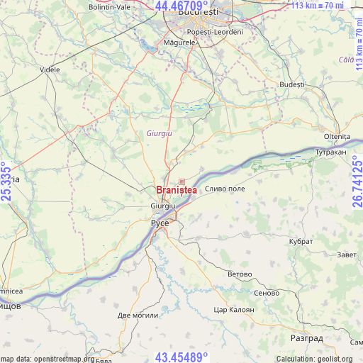
Braniștea GPS coordinates[2]
43° 57' 47.34" North, 26° 2' 17.232" East
| Map corner | latitude | longitude |
|---|---|---|
| Upper-left | 44.46709°, | 25.335° |
| Center: | 43.96315°, | 26.03812° |
| Lower-right: | 43.45489°, | 26.74125° |
| Map W x H: | 112.5×112.5 km | = 69.9×69.9mi |
| max Lat: | 48.23793° ⇑97.5% North |
| Braniștea: | 43.96315° |
| min Lat: | ⇓2.5% South 43.65638° |
| min Long | Braniștea | max Long |
| 20.31667° | 26.03812° | 29.65403° |
| W 63.8%⇐ | ⇒36.2% E |
Elevation
Elevation of Braniștea is 21 m = 69 ft, and this is 233.9 m = 767 ft below average elevation for this country.
| Max E: |
1278 m = 4193 ft | 97.3% |
| Avg. | 254.9 m = 836 ft | |
| Braniștea | 21 m = 69 ft | |
Min E: |
-2 m = -7 ft | 2.7% |
See also: Romania elevation on elevation.city.
Geographical zone
Braniștea is located in North temperate zone (between Tropic of Cancer and the Arctic Circle). Distance of this Northern Tropic circle is 2282.3 km =1418.2 mi to South.| Distance of | km | miles | from Braniștea |
|---|---|---|---|
| North Pole | 5118.8 | 3180.7 | to North |
| Arctic Circle | 2512.9 | 1561.4 | to North |
| Tropic Cancer | 2282.3 | 1418.2 | to South |
| Equator | 4888.2 | 3037.4 | to South |


Nearby cities:
15 places around Braniștea: (largest is in red/bold)
• Bălanu
10.7 km =6.6 mi,  242°
242°
• Băneasa
9.5 km =5.9 mi,  12°
12°
• Cetatea
8.4 km =5.2 mi,  260°
260°
• Daia
6 km =3.7 mi,  313°
313°
• Frasinu
7.1 km =4.4 mi,  350°
350°
• Frăteşti
5.7 km =3.5 mi,  273°
273°
• Ghizdaru
13 km =8.1 mi,  254°
254°
• Giurgiu
10.4 km =6.5 mi,  215°
215°
• Gostinu
7.5 km =4.7 mi,  56°
56°
• Oinacu
2.3 km =1.4 mi,  229°
229°
• Oncești
12.6 km =7.8 mi, 266°
• Pietrele
12.9 km =8 mi,  30°
30°
• Plopșoru
6.5 km =4 mi,  326°
326°
• Remuș
5.1 km =3.2 mi, 244°
• Slobozia
16.8 km =10.4 mi, 221°
Sources, notices
• [Note1] Compared only with cities in Romania existing in our database
• [Src1] Map data: © OpenStreetMap contributors (CC-BY-SA)
• [Src2] Other city data from geonames.org with taken over terms of usage.
• [Src3] Geographical zone / Annual Mean Temperature by Robert A. Rohde @ Wikipedia
