Cetatea geodata
Cetatea (Giurgiu) is a populated place; located in Romania in Europe/Bucharest (GMT+3) time zone. With population of 1,039 people, there are 4158 cities with bigger population in this country. Compared to other cities in Romania, 97.6% of cities are located further ↑North; 61.6% of cities are located further ←West and 96.4% of cities have higher elevation than Cetatea. Note1


Cetatea GPS coordinates[2]
43° 57' 3.78" North, 25° 56' 4.2" East
| Map corner | latitude | longitude |
|---|---|---|
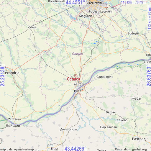
| Upper-left | 44.4551°, | 25.23138° |
| Center: | 43.95105°, | 25.9345° |
| Lower-right: | 43.44269°, | 26.63763° |
| Map W x H: | 112.6×112.6 km | = 70×70mi |
| max Lat: | 48.23793° ⇑97.6% North |
| Cetatea: | 43.95105° |
| min Lat: | ⇓2.4% South 43.65638° |
| min Long | Cetatea | max Long |
| 20.31667° | 25.9345° | 29.65403° |
| W 61.6%⇐ | ⇒38.4% E |
Elevation
Elevation of Cetatea is 27 m = 89 ft, and this is 227.9 m = 748 ft below average elevation for this country.
| Max E: |
1278 m = 4193 ft | 96.4% |
| Avg. | 254.9 m = 836 ft | |
| Cetatea | 27 m = 89 ft | |
Min E: |
-2 m = -7 ft | 3.6% |
See also: Romania elevation on elevation.city.
Geographical zone
Cetatea is located in North temperate zone (between Tropic of Cancer and the Arctic Circle). Distance of this Northern Tropic circle is 2281 km =1417.3 mi to South.| Distance of | km | miles | from Cetatea |
|---|---|---|---|
| North Pole | 5120.2 | 3181.5 | to North |
| Arctic Circle | 2514.3 | 1562.3 | to North |
| Tropic Cancer | 2281 | 1417.3 | to South |
| Equator | 4886.9 | 3036.6 | to South |


Nearby cities:
15 places around Cetatea: (largest is in red/bold)
• Braniștea
8.4 km =5.2 mi,  80°
80°
• Bălanu
3.7 km =2.3 mi,  199°
199°
• Daia
6.7 km =4.2 mi,  35°
35°
• Frasinu
10.9 km =6.8 mi, 40°
• Frăteşti
3.1 km =1.9 mi,  55°
55°
• Ghizdaru
4.7 km =2.9 mi,  242°
242°
• Giurgiu
7.5 km =4.7 mi,  162°
162°
• Hodivoaia
12.4 km =7.7 mi, 244°
• Oinacu
6.6 km =4.1 mi,  91°
91°
• Oncești
4.4 km =2.7 mi,  277°
277°
• Plopșoru
8.2 km =5.1 mi,  34°
34°
• Remuș
3.8 km =2.4 mi,  103°
103°
• Slobozia
11.6 km =7.2 mi,  193°
193°
• Stăneşti
9 km =5.6 mi, 244°
• Vieru
12.2 km =7.6 mi,  234°
234°
Sources, notices
• [Note1] Compared only with cities in Romania existing in our database
• [Src1] Map data: © OpenStreetMap contributors (CC-BY-SA)
• [Src2] Other city data from geonames.org with taken over terms of usage.
• [Src3] Geographical zone / Annual Mean Temperature by Robert A. Rohde @ Wikipedia
