Ezeriş geodata
Ezeriş (Caraş-Severin) is a seat of a second-order administrative division; located in Romania in Europe/Bucharest (GMT+3) time zone. With population of 1,362 people, there are 3412 cities with bigger population in this country. Compared to other cities in Romania, 56.8% of cities are located further ↑North; 95.2% of cities are located further →East and 51.8% of cities have lower elevation than Ezeriş. Note1


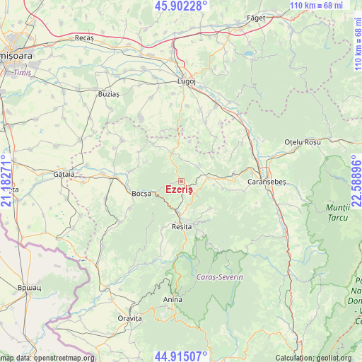
Ezeriş GPS coordinates[2]
45° 24' 38.988" North, 21° 53' 8.988" East
| Map corner | latitude | longitude |
|---|---|---|
| Upper-left | 45.90228°, | 21.18271° |
| Center: | 45.41083°, | 21.88583° |
| Lower-right: | 44.91507°, | 22.58896° |
| Map W x H: | 109.8×109.8 km | = 68.2×68.2mi |
| max Lat: | 48.23793° ⇑56.8% North |
| Ezeriş: | 45.41083° |
| min Lat: | ⇓43.2% South 43.65638° |
| min Long | Ezeriş | max Long |
| 20.31667° | 21.88583° | 29.65403° |
| W 4.8%⇐ | ⇒95.2% E |
Elevation
Elevation of Ezeriş is 221 m = 725 ft, and this is 33.9 m = 111 ft below average elevation for this country.
| Max E: |
1278 m = 4193 ft | 48.2% |
| Avg. | 254.9 m = 836 ft | |
| Ezeriş | 221 m = 725 ft | |
Min E: |
-2 m = -7 ft | 51.8% |
See also: Romania elevation on elevation.city.
Geographical zone
Ezeriş is located in North temperate zone (between Tropic of Cancer and the Arctic Circle). Distance of this North polar circle is 2352 km =1461.5 mi to North.| Distance of | km | miles | from Ezeriş |
|---|---|---|---|
| North Pole | 4957.9 | 3080.7 | to North |
| Arctic Circle | 2352 | 1461.5 | to North |
| Tropic Cancer | 2443.3 | 1518.2 | to South |
| Equator | 5049.2 | 3137.4 | to South |


Nearby cities:
15 places around Ezeriş: (largest is in red/bold)
• Bocşa
14.4 km =8.9 mi,  253°
253°
• Brebu
8.4 km =5.2 mi,  82°
82°
• Câlnic
8.3 km =5.2 mi,  195°
195°
• Delinești
14.8 km =9.2 mi,  99°
99°
• Doman
16.4 km =10.2 mi,  171°
171°
• Fârliug
9.1 km =5.7 mi,  341°
341°
• Lupac
15.6 km =9.7 mi, 201°
• Ocna de Fier
11.8 km =7.3 mi,  222°
222°
• Ramna
15.7 km =9.8 mi,  281°
281°
• Reşiţa
12.2 km =7.6 mi,  178°
178°
• Soceni
6.4 km =4 mi,  131°
131°
• Târnova
12.1 km =7.5 mi, 128°
• Valeapai
15.5 km =9.6 mi,  305°
305°
• Zorlenţu Mare
7 km =4.3 mi,  51°
51°
• Țerova
11.8 km =7.3 mi, 165°
Sources, notices
• [Note1] Compared only with cities in Romania existing in our database
• [Src1] Map data: © OpenStreetMap contributors (CC-BY-SA)
• [Src2] Other city data from geonames.org with taken over terms of usage.
• [Src3] Geographical zone / Annual Mean Temperature by Robert A. Rohde @ Wikipedia
